|
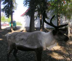
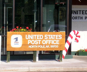
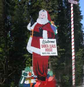
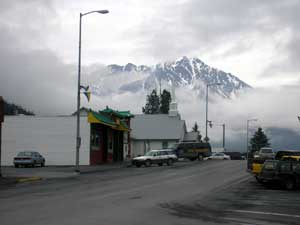
North Pole - AK |
| Friday, June 2, 2006. We're heading to Denali National Park. We stopped into the North Pole... in Alaska... an then spent the next day in Fairbanks. It reminds us so much of Timmins except much busier and lively. I found out to-day that the Forget-me-not flower is the official flower of the State and rightly so. Alaska seems to have been forgotten by the rest of her States. When you see "we will deliver anywhere in the USA" and an Alaskans goes to order the item the retailer will say "O, except in Alaska. I bought an atomic clock that synchronizes with a tower in Oregon. This tower sends out a signal (Wave) to make sure the time is the same throughout the USA. I have to set the time zone to either Eastern, Central, Mountain, Pacific. When we enter Alaska, the clock only has those 4 settings, but luckily there is a "manual" setting. Another rejection for Alaska but I think because they are so remote from their other States it has made them stronger and more independent. |
 |
 |
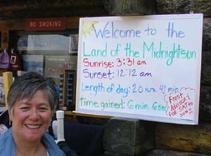
In Fairbanks,
we saw a road sign that said |
 |
 |
 |
|
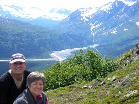
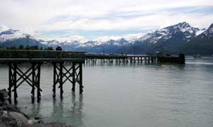
Fairbanks - AK |
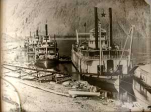
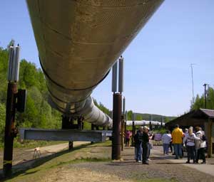 The Alaskan Pipeline. It travels around 600 miles, some of it above ground and some below ground. It is not anchored down and on pillars in case of earthquake. The "antennas" on each post is actually a cooling system which keeps the post cold so that it does not thaw the ground it's in, as it is in perma-frost.
|
 This is the most northern we have gone and it seems to be light all the time, even when it's dark.. It's strange but I like it. I feel I have so much more energy. Denis is not fussy about it. He claims he cannot sleep properly. I know once his head hits the pillow he is snoring. He just has to close his eyes.
|
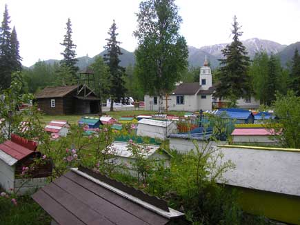
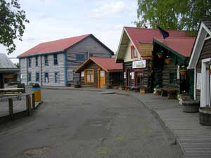 Pioneer Park. 44 acre, historical pioneer theme park and family recreation area, was built in 1967 for Fairbanks 100th. anniversary of the state's purchase from Russia for round 7 million dollars, what a steal. These homes where built in the early 1900's and instead of knocking them down they were relocated to this park and within are people re-enacting the people who lived in them and some are now gift stores. |
|
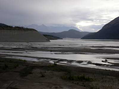
Nenana - AK on the way to Denali |
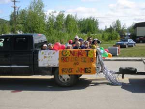
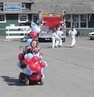
| Sunday, June 4, 2006. While travelling to Denali, we stopped in at this small Town of Nenana, the Visitors Center. They were having their Memorial Day parade. This little town has two Ididerod mushers living here and it has a great little lottery, Nenana Ice Classic, where you guess the time a wooden "A-frame" structure crashes through the Spring thaw ice on the river. It's only $1.00 per ticket and this 50/50 draw has a grand prize of over $200,000.00!!! It's been going on for over 85 years. We also met a past governor of AK here. |
 |
|
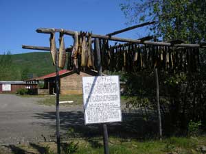 This is fish that is hung winter and summer to cure for the dogs that are musher's. I cannot figure out how they keep the bears away. |
|
Denali - AK |
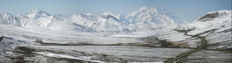
| Sunday, June 4, 2006 We are camped at Denali National Park, the weather is really bad, too cloudy to see Mt. McKinley which is our main reason for coming here. It has been about -7C in the morning. On Monday it snowed in late afternoon and was really cold. We have a trip to go on a bus ride on Tuesday and it has finally cleared up, we should see Mt. McKinley. This is one National Park we could not go into the park by ourselves, except for about the first 15 miles. We had to pay $24.00 for a bus ride into the park where "The Mountain" could be viewed. There is so much control here that it takes the fun out of visiting. |
|
|
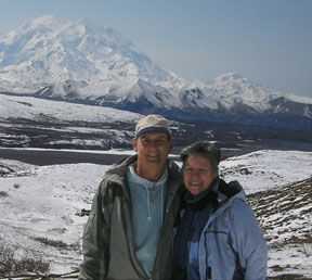 Finally after 3 days we were able to see Mt. McKinley. We're told a cloudless clear day like what we got happens about 30 times a year. We were lucky the weather cleared or we would have had to pay $24.00 and see a whole bunch of clouds. The mountain if measured from the base is taller then Mount Everest but there are a few higher mountains in the world as this one is only 20,320 ft. high. |
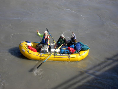
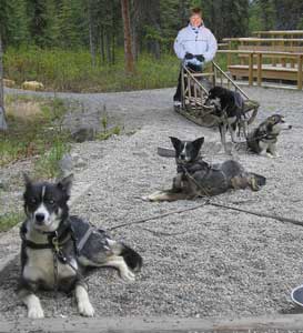 We went to see a mushing demo while at the park. |
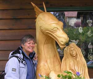
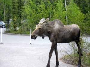 While leaving the visitors center at the park I was greeted with a visitor. |
 |
|
Anchorage and Eklutna along the way to Homer |
| Tuesday, June 6, 2006. We visit the village of Eklutna along the way. Historic town originally inhabited by Russians orthodox missionaries and the church and the cemetery show the influence. |
 |
Old St. Nicholas Church in
Eklutna The small Russian Orthodox chapel was built in 1870 and around 1900 it was moved to Eklutna. Gauze screens the log walls inside, the floor is of rough planks, and except for the alter, the interior undecorated. The chapel served this small Tanaina Athapaskan village until replaced by the adjacent frame structure in 1962 and the old chapel now serves as a historic building. The Russian Orthodox seem to play a big roll with the Athapaskan natives. |
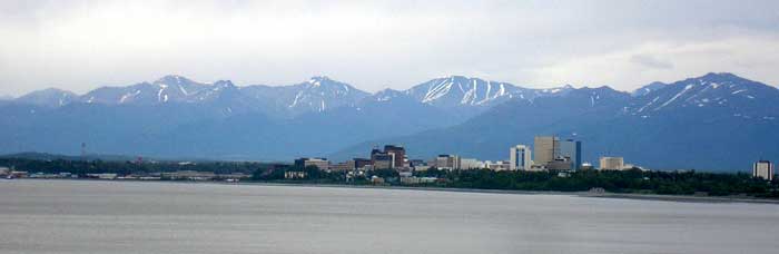
| Stayed in Anchorage for a couple of days and enjoyed going to the Anchorage Museum of History and Art. Anchorage is a BIG city with over one Million residents. No boondocking here as this City is reported to have a high crime rate. We spent a couple of days at the municipal campground and it was visited every day by the police. |
|
|
 There was so much art and history about Alaska here that you could not cover it in a day. |
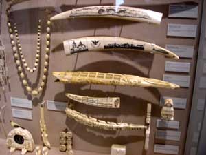 Beautiful carvings out of Walrus/Mammoth tusks. |
 The Athabaskin Indians made bags from fish skin. |
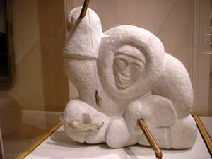 Carvings out of Marble |
 Pictures showing the past. |
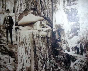
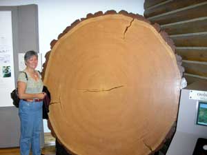 This tree is 600 years old. |
| There was so much to see here that I would come back again. |
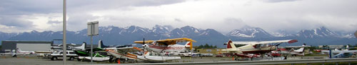 There are about 5 airports here. There is always a plane in the sky. This airport is on Hood lake. The worlds largest water base airport and we must have seen thousands of airplanes all around the shore of it. |
|
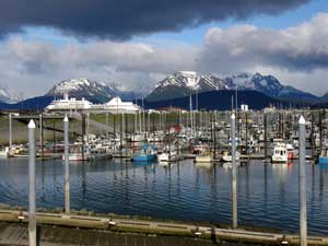
Homer, AK |
| Thursday, June 8, 2006. We
continue down the
Kenai
peninsula and are
in Homer. AK., camping on the
Spit - a very long sandbar. Since we have left Anchorage, we have been eating Salmon every day.
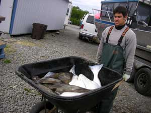
The Kenai Peninsula is a huge fisherman's paradise. Fish canneries, to
can or vacuum pack their salmon. People for hire to clean wheelbarrows full of Halibut, that a chartered boat came in with, the days catch.
Salmon rivers full of fisherman "combat fishing", all lined up along the
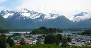
shores. It's super scenic and quite an experience driving the Kenai. Stayed at the Homer municipal campground (no supervision). Our neighbour had his loud, cheap generator on until 1:30 p.m. I was not impressed with him. The parks in the Homer area are like parking lots, you drive into a slot and your neighbour is right beside you. You are so close you can hear everyone's heating system start up and see into each others living quarters. I was told that since the native Alaskans have so much of darkness/winter that when it is daylight hours they make the best of it and stay up late at night. We did have a previous Alaskan neighbour next to us at Homer and they were very courteous. I guess there is always a bad apple in the barrel |
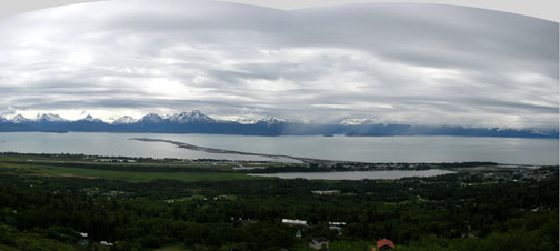 This is the town of Homer on the right side of picture. That long sliver of land jutting out into the ocean is a sand bar (aka the spit). That spit was left over by the Glaciers when it passed through. We are camped out on the spit and it's about 1 mile long and has a huge marina full of fishing boats, a small town with loads of businesses, 2 campgrounds, etc. etc.... busy place. |
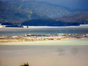 This is a telescope view of the spit in Homer. There is a lot of action here and another community of stores and trailers. |
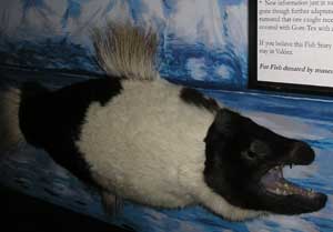
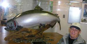 Denis is getting blinded by the size of this fish. Great little display at the Ninilchik Visitor Centre. Halibuts, on the right and below, otherwise known as "barn doors", because of their flatness and sometimes are as big, or were as big as barn-doors, and very good to eat. |
 |
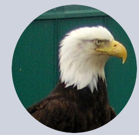 Bald Eagles just waiting for the scraps of fish. Do they not look mean? There are a few of these guys at the campsite looking for what's left from the fish cleaning. When I took this picture there were 3 of them. This one was posing for us. |
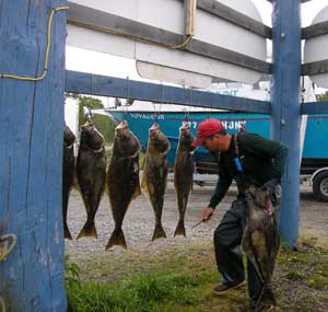
 The Kenai Peninsula is all about fishing. Everywhere there is evidence that fishing is a big thing. |
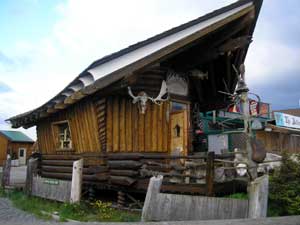 This is one of the stores. Really nice carpentry work.
|
 We had joined our friends Judy and Pierre in Homer and they will be leaving to-day. I think Judy misses her family because she kept feeding us. They are now like family and we will miss them but you never know we might meet again. Au Revoir, mon ami. |
 There are about 1000 slips here and we think the marina is full. The town has only about 4,000 people. Figure that one out.
|
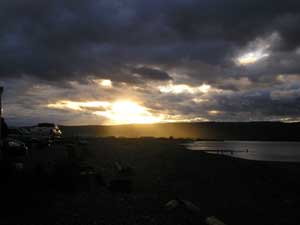 This is at 10:30 p.m. Still not dark and we are quite a bit further south then when we were in Fairbanks.
|
 I would love to take credit for this picture but no, someone else took it and I thought it was precious. There are so many artist in Homer. |
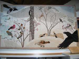 All types of Quilts.
|
 Woodwork |
 Ceramic
tiles. Ceramic
tiles. |
 Paintings.
|
All local artist. They create what they see and live in. Their
art is an expression of their life. We have eaten a whole lot of fish. We are getting our Omega 3 since Anchorage we have eaten Salmon and Halibut every day. |
 There are many Russian communities. Our friends Judy and Pierre told us we had to try this one. It was a very weird and interesting lunch, thanks to their recommendation. Find Nina in Nikolaevsk. |
 You think your vegetable are expensive. The bananas are .99 cents a lb.
|

|
|
Saldovia, AK |
| Wednesday, June 14, 2006. While in Homer we took a boat ride to the charming town of Seldovia. The boat ride there was really scenic, and there was lots of wildlife along the way, including a whale (we missed the picture). |
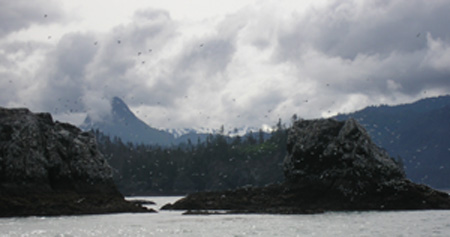 |
On the way to Saldovia we saw Islands full of different birds. |
|
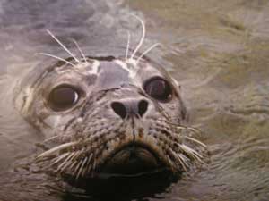
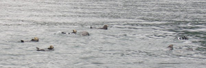
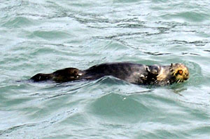
Schools of otters. They love to float on their backs. On the right, a close-up of an otter. |
 |
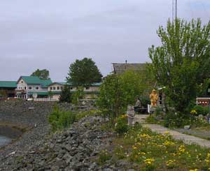 |
Saldovia was a busy, thriving town in 1898 with many stores, a modern hospital, good schools and Russian Orthodox and Methodist churches. The Alaska Steamship Company made regular stops with freight, mail and passengers. Before the Sterling highway linked Homer with the rest of the world, Seldovia was the main town in this area and one of the country's busiest seaports. Now, due in part to the 1964 earthquake and changes in the fisheries & transportation systems, Seldovia is a quiet little village. They have a annual Chain Saw Carving Contest. Summer Solstice Music Festival and a 4th. of July Parade, pancake breakfast, and rubber ducky race. |
 |
|
Back up the Kenai Peninsula, stopped in Seward, AK |
| Wednesday, June 14, 2006. We are traveling back up the Kenai peninsula. This is a very scenic road all way between Anchorage and Homer. We're at the Russian River campground. We had to go into the overflow area because they were full (another parking lot setup). Everyone is fishing salmon in earnest. We call it combat fishing, where everyone has his little 5 feet of shoreline space. This time there was a Huge Class C, 3 lots next to us. Wouldn't you know it. They went fishing and when they got back at 11:00 p.m. they started their generator around 12:00 and at 1:30 they were still running it! |
| Thursday, June 15, 2006. We are in a regular campground to-night. I am so glad, no really close neighbours to disturb us. (I hope). I would like to get a full nights sleep. We spent the day in Seward, and enjoyed the Alaska SeaLife Center, we also saw a film of the 9.2 earthquake that started in Valdez to Anchorage. What a horror picture that was. It was on Good Friday in 1964. Where was I then??? I do not even remember hearing about it but from the film and other pictures we have seen in the museums, it was disastrous. |
|
|
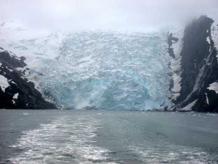
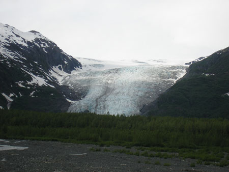 Exit Glacier right off the roadway into the Kenai Fjords National Park main entrance. This is the only road that actually goes into the park. This glacier is one of 32 glaciers produced by the Harding ice field, which itself, covers most of the interior of the Kenai peninsula with a few thousand feet thick of ice. There are more Tidewater glaciers in this park (glaciers that still go right down to the waters edge) than anywhere else in the world from one ice field... even though they are all receding. The picture above shows the Exit glacier at about 1.3 miles away. It was just below the picture in the mid 1800's! The picture to the right is of two park rangers surveying a new walking path as the one we are now using is too far away... and it was built just 12 years ago!
|
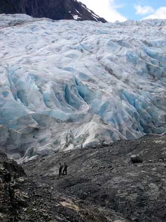 Exit
Glacier from hiking trail. Exit
Glacier from hiking trail.
|
 Another view from SeaLife Center in Seaward. Enjoyed petting all the live stuff there.
|
 The downtown has mountains around it. It's such a pretty view.
|
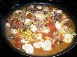 We met some really nice people from Switzerland in Homer, and they went Halibut fishing. They gave us some of their fish and I made a Halibut Stew. It was really good. Thank you. |
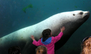 This was a very affectionate Sea Lion and a bit of a ham. Alaska SeaLife Center.
|
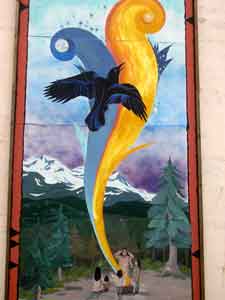 |
There were painted murals on a lot of buildings downtown. |
|
Whittier and tidewater glaciers cruise, AK |
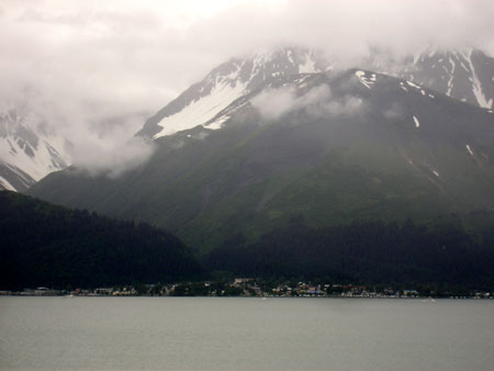
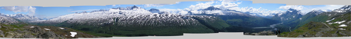
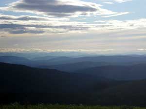
| Sunday, June 18, 2006. We are in Hope, AK today. Our base for the boat trip to the tidewater glaciers. The Spruce Bark beetle has infected a lot of Alaska but we can especially see it here. It is sad. We stayed a couple of nights in Portage Valley, what a place. If it is not raining, it is snowing, is what we were told and I believe them. It rained all the time we were there. During that stay we went to Whittier for a cruise. This cruise takes you to a number of Glaciers. Billings Glacier, Learnard Glacier, Blackstone Glacier, Beloit Glacier, Marquette Glacier, Lawrence Glacier Ripon Glacier. The weather here has been about 2 to 9 degrees C, in the morning. The heat kicks in at 13 degrees C often during the night. |
 Can you believe we are still looking at Glaciers (a HUGE piece of ice). We went for a cruise at Whittier. It rained the whole time but we made the best of it. It helped that the cruise included a buffet of Salmon and Prime Rib. What is a Glacier? A glacier is a large body of ice that forms on land, remains year-round, and is moving. Often referred to as "Rivers of Ice," glaciers exhibit many of the same characteristics of rivers. Like rivers, glaciers begin at the top of the mountain and, taking the path of least resistance, gradually make their way down the mountain under the pull of gravity. Although all glacial ice is moving down slope, not all glaciers are advancing. Advancing glaciers and retreating glaciers result from a net gain or a net loss. If more ice flows down slope than is lost at the toe of the glacier by melting and calving (the process of ice breaking from the face of a glacier), the glacier would be an advancing glacier. The opposite conditions would signal a retreat. |
| During this trip I learned there are Ice Worms in the Glaciers. They resemble a piece of dark thread and is 2.5 centimetre (one Inch) and .5 mills. in diameter. These ice worms eat red algae, which grows on glacial snow packs and possibly pollen grains blown onto the glacier. Heat is the ice worm's enemy. If the surrounding temperature increases much above 4 C (40 F), they become lethargic and begin to disintegrate. If a human finger touches an ice worm it may instantly die from the heat. |
 To get to Whittier we went through a 2.5 mile toll tunnel through Chugach Mountain, the longest tunnel in North America. This tunnel is scheduled so that the trains go through and then vehicle traffic. Whittier is suppose to have a mild maritime climate with a maximum of 84 degrees & a minimum of -29. Mean snowfalls is 260 inches annually and winter winds can reach 60 miles per hour. It rained the whole time we were there. |
 Whittier is surrounded by the Chugach National Forest, the second largest National Forest in the US, and three of North America's major ice fields. The city itself is a historical landmark, established by the U.S. Army during World War 11 as "the secret port". After the war, the Army built two large buildings which are now landmarks. The 14-story Begich Towers is now a condominium that houses over half of Whittier's population along with its post office, city hall and medical clinic. There are quite a few restaurants here and just a couple of gift shops. |
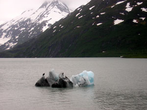 ICEBERG!!! ICEBERG!!! Denis was so excited to see a floating iceberg that he pulled over and took a picture just before entering a tunnel. This iceberg is in Portage Lake and Portage Lake was made from Portage Glacier. From our trailer park we can see Portage Glacier.
|
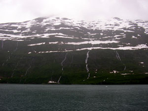 There are streams flowing down all the mountains from the melting snow. |
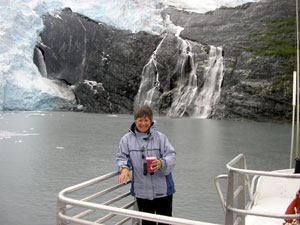 On my right a glacier, on my left waterfalls and in my hand a warm Kenai Kicker. |
Why is the Ice Blue? Glacial ice is formed under pressure, creating ice with few cracks or air bubbles, unlike the ice cubes in your refrigerator. The visible light from the sun is made up of the spectrum of colors that you see in a rainbow. When the sunlight strikes glacial ice, most of the colors of the spectrum are absorbed - only the blue wavelengths are reflected to your eye. On an overcast day, clouds filter colors such as reds, oranges, and yellows, making glacial ice appear a more intense blue. |
|
Glen Hwy on the way to Valdez |
| Tuesday, June 20, 2006. We are back in Anchorage and notice
the weather is warmer, we even see sunshine. Denis is having some adjustment
done on the truck and then we will head to Valdez Thursday, June 22, 2006. We are on the Glenn Highway today. Weather is cloudy/rainy. It is too bad because this is such a scenic drive with snow capped mountain ranges on either side, which we can see sometimes between the clouds. We are staying the night along the highway and having a feast of Alaskan King Crab. What a way to end the day. |
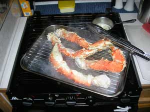  This is our second feast of Alaskan King Crab. The first was just a couple of pieces. A teaser. The price was right $11.49 per lb. Boy am I ready for this. Apron on for the battle. Garlic butter for flavouring. Caesar Salad for roughage. |
|
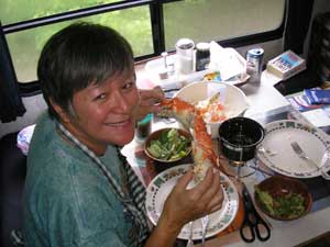
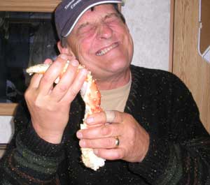 Denis is having a battle with this one. |
|
Valdez |
| Friday, June 23, 2006. Spent the night at Blueberry Lake and will visit Valdez tomorrow. The weather has cleared up today. It feels a little like spring but we think this is their summer. |
 |
|
|
Major Historic Events: 1898 Gold Rush Stampede In 1964 the Alaskan (9.2 measured) earthquake totally destroyed the town of Valdez because it was built over a gravel alluvial fan created by the Valdez Glaciers. The town was rebuilt 3 miles further upstream. The worst concentration of deaths from the earthquake occurred when the main dock which had 30 people standing on it suddenly dropped 30 feet into the water. (on Good Friday) In 1970's, the port of Valdez is made the southern terminus of the
Alyeska (Alaska) pipeline and Marine Terminal. |
 This is a view from our trailer window. Denis is enjoying this so much that he is sitting outside and pretending to read but he is really enjoying the view.
|
 All around is signs of spring. Western Columbine |
 Valdez has a big harbour, many charters and transportation over to Juneau, the capitol of Alaska. |
 Even with all the snow in the mountain the lawns in town need to be mowed. |
 A partial view of Valdez. It is surround by mountains and very picturesque, friendly city of 41 years old. I think hardship has a way of melding the people closer together. |
 They even have arctic salmon fish here!
|
| I am in need of a hair cut but when I found out it would cost me $35.00 US, I said I would let my hair grow. Things are pricy in Alaska areas. |  |
| A little tidbit about Valdez, Alaska: Average annual
rainfall = 64.04 inches |
= I would have to say this applies to a lot of places in
southern Alaska. I could be wrong. Some places less and some more. |
|
The Copper River, Chitina, McCarthy and the old Kennecott mine |
| Sunday, June 25, 2006.
We are camped at the
Copper River,
just 1.5 miles from the
Town of Chitina. The Copper River is known to have the
best Salmon in the world. This Salmon has the highest count of Omega
3. We met Becky and Len from Wasilla. They were really nice and treated us to freshly caught Red
Sockeye salmon.
Becky went out of her way to help us find a good spot to park our trailer,
since we are not familiar with the area and she said there are really high
winds here. The salmon was such a treat. Thank you again, Becky & Len. Tomorrow if the weather is good we will go on the 60-mile gravel road to the Kennecott River then to the towns of McCarthy and Kennecott and the historic Kennecott Mine where Kennecott Copper Mines first started. On Tuesday we met Dan and Linda from Fairbanks. They both work at the University. They also gave us a fresh Copper River salmon fillet. These kind people of Alaska are spoiling us! The salmon is so good that salmon back home will never be good enough. I really hope they keep in touch with us. Another fisherman offered us a salmon but Denis refused knowing how difficult it was getting them since the fish wheels were not productive. What a lot of the fishermen are not doing is dip netting from shore or drift netting from a boat. It is not an easy catch for the salmon to get close to shore they have to wait until dark which around here is 12:30 for about 3 hours, add to that the fact that this section of the copper river acts like a narrow end of the funnel and you can get wind gusts of 30 to 50 miles per hour. Last night was bitterly cold and they are standing waist deep in glacier cold water trying to keep their balance. It is not easy. You have to be tough to live here. |
|
|
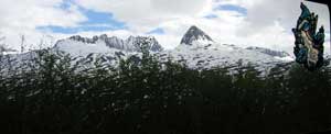
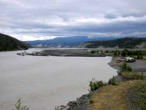 This is the Copper River. Here you get the best Salmon in the world. You have to be a native Alaskan resident to fish for the red, silver, and king salmon with dip nets and fish-wheels with limits of up to 500 salmon in possession. The mountains visible is volcanic Mount Drum (12,010), part of the Wrangell Mountains.
|
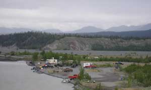 Anyone can dry-camp here and we choose to stay and watch the action and what an interesting event it was. This was also our staging area for visiting Kennecott 60 miles away.
|
 Here we have people fishing with dip-nets. Scraping bottom with them and hoping to scoop up a bundle. |
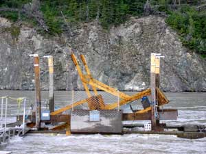 A fish-wheel. The wheel turns like a wind mill being pushed by the current and hopefully scoops up the fish then dumps them into the holding cage. |
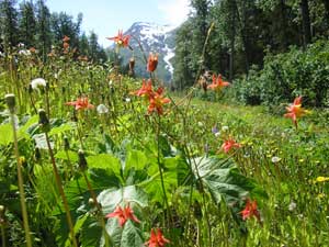
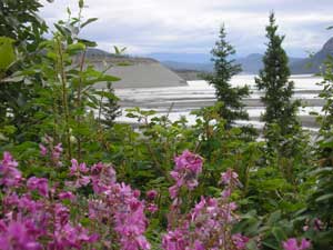 Spring has sprung and the wild flowers are in bloom.
|
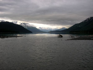
This are is a view of the confluence of the Copper and Chitina Rivers.
The Copper is the only waterway that cuts through the Chugach Mountains.
The Copper is about 1/2 mile wide, while the Chitina is over one mile.
The rivers look dirty...but they are not polluted. These waters begin as
flowing "rivers of ice." Millions of tons of rock dust are scoured off
of distant mountains by glaciers and carried downriver each year. The
silty waters hide salmon swimming up these rivers to spawn. Copper River
"Reds," (sockeye salmon) are world renowned.
|
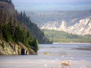 |
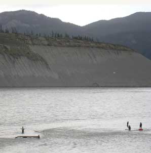
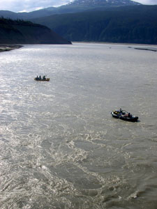
We met Brenda, Katherine and James at Copper River. They are from Homer.
The river that you see them rafting on in the pictures. There was an
auction and Brenda had bid and won this trip for her friend only to find
out the friend did not want to do this rafting trip on the copper river
from Chitina to Cordova so now the good sport that she is has taken her
family on an adventure that they will never forget. By the way Brenda is
a Canadian and seems to be living life to her fullest. Keep it up
Brenda. Life is way too short.
|
 |
 |
Salmon Anyone
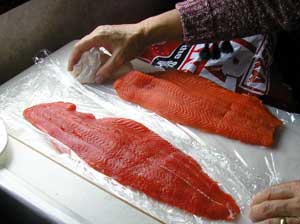 The salmon is so tender that your fingers could go through it. The Copper river salmon is so oily you can see the white stuff running down the middle... and this makes it the highest in Omega-3 content.
|
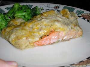 While visiting one of the fish possessors I picked up some new recipes for salmon. This is one of them. Alaska Salmon Potato Stack. Shredded Potatoes, cheddar cheese, cream of broccoli soup, garlic salt, dried minced onion, dried dill weed all mixed together. Sprinkle lemon juice and lemon pepper on top of salmon and then top mixture on top of salmon. Bake15 min. |
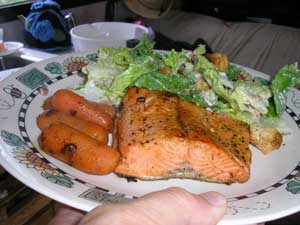 This is just pan fried with spices and lemon. Just as delicious.
|
|
The Kennecott Mine Road This part of Alaska is special. Here you first reach the historic town of Chitina (pronounced Chit-na) where two civilizations live. First the original native settlements found to the south of town which date back to pre-explorer times are still occupied, and the town itself, which is currently mostly inhabited by "Outsiders" who moved to Alaska in the late 60's early 70's, many from the Vietnam war era. But this town really came to being in the early 1900's when it was a major supply centre for the Kennecott mine. Just a mile past town is the copper river where we are camped out. The Kennecott Mines built a railway line from the mine site all the way down to Cordova on Prince William sound (Pacific ocean), a distance of 196 miles, to ship its ore to Washington state for smelting and refining. Chitina is at a midpoint, about 60 miles from the mine site. The Copper river crossing, where we are, had a wooden trestle which was wiped out every Spring by the river ice break-up. This trestle was about 1/4 mile long and had to be rebuilt every Spring! You can see a picture of the river up above we took from the concrete bridge. The road into Kennicott is over 60 miles of the old railway line and sometimes, you still see the railway ties or the odd spike coming out of the roadbed! Of course the rail lines are removed but what a road this is. At Kennicott, the mine mill is the attraction and is now part of the Elias National Park. The town itself was small with all workers except management, living in bunk houses. The next town 5 miles over, McCarthy existed mostly because it provided services Kennecott mines would not allow in Kennicott, such as competing general stores, saloons and establishments with "loose ladies"! Ah, the good old days. |
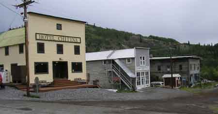 View of the Chitina downtown. Hotel has recently been renovated, next one is partly done and the far one is an original 2 storey log structure. This is a really nice small town with very friendly folks, many of whom have been here for 35 odd years.
|
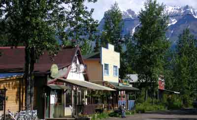 This is downtown McCarthy which is celebrating its 100th! . Pop about 50 in the summertime, a few less in Winter. Again, great folks, and as always, renovating buildings, which is a major feat since they are 60 miles down a narrow gravel road which used to be a railway bed and another 100 miles to the nearest building centre! |
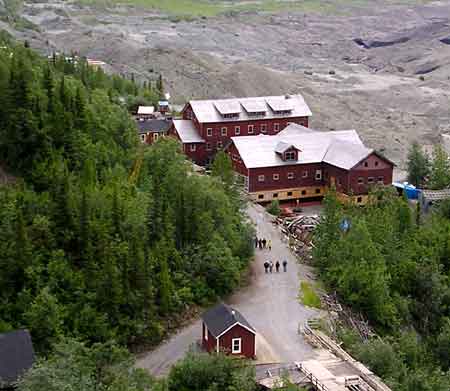 View of downtown Kennicott from atop the mill. You see the watchman's shack below, the general store being refitted with a new foundation and one of the many bunkhouses for the workers next to it plus a partial view of the school house beyond. The bunkhouses, by the way, were occupied by 2 shifts of men who had to give their bed away to the next shift when they went to work! The gravel piles past these structures are not tailings. They are the remains of the Kennicott glacier. Under the rubble is solid ice which is still melting away and which 100 yrs ago was at least 200 feet higher right where you're looking! |
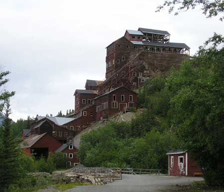 This is the famous Kennecott mill and concentrator... the mine itself is about 2,000 feet higher up in the mountain behind it. This mine made the owners...JP Morgan and Guggenheim brothers, richer still as it was the richest copper find ever. Reported overall grade of the copper ore milled was 17%, some of which was 70% straight from the mine. Visiting this place is going back in time like nowhere else because when they shut this mine down, they basically took everyone out of town and said, this is the last train... get on or walk out! Supposedly, some homes still hade meals left on the tables, years later! |
|
Heading back towards Tok, a stop over in Eagle, then on to the Yukon |
| Wednesday, June 28, 2006. We are on the "Taylor Highway" just past Tok. Have visited the town of "Chicken". It is a small mining town, everyone looking for his Eldorado. In Winter, the town is basically empty. I heard somewhere that way back when the town was formed, there was a town meeting to discuss what to name the town and because there where so many Ptarmigans (Arctic partridge) they decided to name the town that bird but no one could spell the name so instead it was called "Chicken". How true this is, I do not know. |
| Sunday, July 2, 2006. We
spent the whole day in Eagle,
Alaska. The road to Eagle was not as bad as we
anticipated but it was a very winding gravel road and the grader must have
passed not too long ago. When we leave tomorrow we will go to
Dawson City in the Yukon. In the Winter, the 60 mile road into Eagle is not ploughed and everyone is "locked in" for a good six months. We saw folks travelling down the road with a trailer full of freezers and running generator. We think they are shopping in TOK for their Winter grub. |
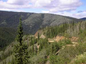 The road was really winding but had some really nice views. |
 This view reminded me so much of the "Blue Ridge Mountains". |
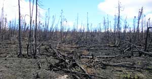
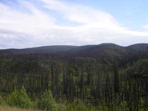 Miles of burnt forests. |
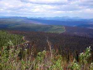 |
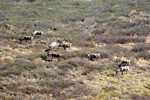
Forest fires happened in the last couple of summers. It is so sad to see miles and miles of burnout. You look at it and think of what happened to all the animals that lived in that forest. The soil contains what's called Caribou moss in which a fire grabs onto and burns like a candle wick forever. It's feared that the Caribou may not come back this year. It may take 50 years or more for this forest to come back. |
 |
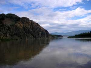 Part of the view of the Yukon River in Eagle.
|
Eagle is originally an Athapaskan settlement, the
discovery of Klondike gold brought an influx of prospectors into the
Eagle area. The town of Eagle was started by a group of miners in 1897,
and incorporated in January 1901, making it the first chartered city in
Alaska's interior. The military built and maintained "WAMCATS"
(Washington-Alaska Cable & Telegraph System) linking Eagle and Valdez.
The fort was abandoned in 1911 except for a small Signal Corps
detachment which remained to operate the wireless. The City of Eagle was named to the National Register of Historic places in 1970, and became the headquarter of the Yukon-Charley Rivers National Preserve 1981. |
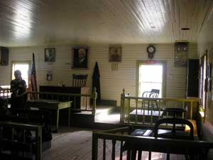 They have restored "Fort Egbert" and offer a really good tour "of the history of Eagle and how it was to live there, then and now, at 9:00 a.m. starting at the Court House. The tour offers to much to put on the web-site. It's a must see. |
 |
 |
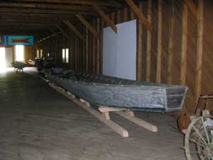
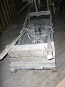 Modes of transportation. |
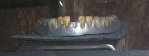 Animal Teeth Dentures Nimrod had scurvy in 1905 and lost all his teeth. He made his own false teeth from sheep, caribou and bear teeth, set in aluminium. Wore them nearly 25 years. |
 |
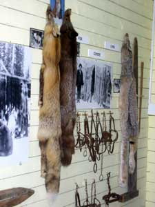 Furs
trapped for clothing for the 70 below weather. Furs
trapped for clothing for the 70 below weather.There is so much more to see here. |
Home l The Beginning l Next