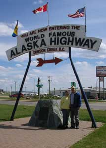
| Monday, May 15, 2006. Today we leave Dawson Creek at "Mile 0", of the Alaskan Hwy. This section will cover our travels on the Alaskan Highway from the province of BC and Yukon Territories Canada, into Alaska,, USA |
|
|
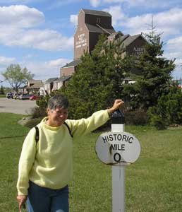 |
The Mile 0 Post - Dawson Creek - BC The "Traffic Circle" located at the intersection of Alaska Avenue and 8th street marks the designated Mile 0 of the Alaska Highway. A plain four-foot post once marked the site. In 1946, when this was hit by a car, a new Mile 0 Post was designed and moved to the centre of Dawson Creek where it stands today. The Mile 0 Cairn in Northern Alberta Railway Park was erected in the late 1950s to replace the original post that marked the "true" beginning of the highway north. Clear as mud - right?
Did-ya-get-all-that! |
 |
 |
There seems to be some confusion as to where Mile 0 is!!!
They have moved it several times. We hear sometime out of fun the mile post was hidden or moved. We are pretty sure that the one I am leaning on is the true Mile 0 but I could be wrong.
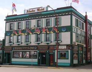
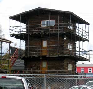
Best looking hotel we've seen yet... eh! |
 |
| In the early hours of March 9, 1942, the first troop trains
of the United States Army Corps of Engineers arrived in Dawson Creek to
begin construction of the 2450 Kilometre (1,523 mile) Alaska Highway.
Overnight Dawson Creek was transformed from a small agricultural community
of 500 into a bustling terminus for troops and supplies. At peak
construction the population swelled to 10,000. Tent cities sprang up in
farmers' fields to help house the massive influx. The Northern Alberta
Railway Station, the "end of steel", became a centre of activity and,
sometimes, temporary home for thousands of military and civilian workers,
many of whom arrived with little knowledge of road building - or subzero
temperatures.
During construction Dawson Creek served as a clearing house for supplies and
equipment, as well as workers. In the spring of 1942 some 600 carloads of
tractors, bulldozers, fuel and supplies arrived by rail from Edmonton for
dispersal to construction camps along the route north. Though the highway was completed in record time, it was not without its mishaps. One of the worst tragedies occurred in Dawson Creek in February 1943 when 60,000 cases of dynamite exploded in the centre of town, injuring many but, miraculously, taking only five lives. The explosion levelled an entire city block. |
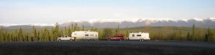
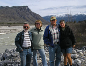
| Today we have also met up with the "Quebec Connection" (Pierre and Judy), by Fort St. John at Mile 52 of the AH (Alaska Hwy.) and decided to travel together a bit. It is nice to have company and they are such good company because they always feed us with their good baking and meals! The top picture "North to Alaska" is of their truck/trailer and ours as we boon-docked for the night. A big black sow bear paid us a visit last evening. It was one of the highlights of the evening. |
 |
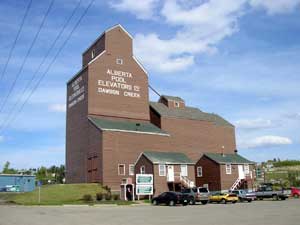
They converted this grain elevator into the "Dawson Creek Information Centre". --->
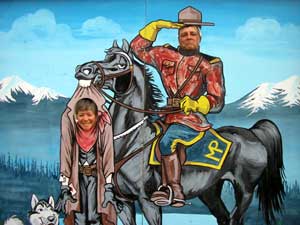
<--- Da gang... la, la, la... |
 |
 |
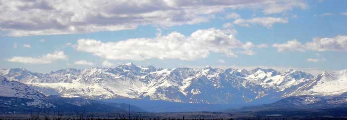
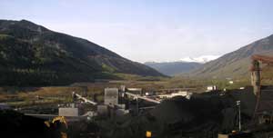
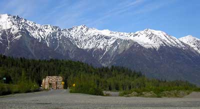
Along the way we saw a coal mine and a lot of gas wells while driving
between Grand Cache, AB and Dawson Creek, BC. --->
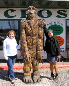
<--- The girls made us stop for this handsome son-of-a-gun! |
 |
|
Fort Nelson and the Fort Nelson Heritage Museum - on the Alaskan Hwy |
| Tuesday, May 16, 2006. On our way to Fort Nelson. Hopefully we will stay in the area for a couple of days. Well we did not stay here but we did have a good time here. Fort Nelson is a unique place. The people are very friendly and enterprising. The Fort Nelson Heritage Museum is one of the best museums we've seen. We also noticed that they really need people to work here and in Grand Cache with advertised jobs of $14 to $17 an hour for submarine shops and McDonalds!. |
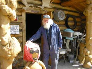 This is Marl Brown. Chief, cook and bottle washer and a most interesting character, handyman, inventor and collector of antique cars and anything antique. He's probably the reason for this museum's existence and it's a must stop and see when on the AH.
|
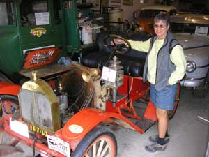 Of the many antique cars he owns, this one is a gem. It's a 1909 Brush. A British car made in Detroit till 1915. It was brought to Calgary by a lady and bought by a doctor who then sold it to Marl's father for $1.00 (bill of sale available). It's got a wooden frame, wooden axles! and wooden wheels, all original and it runs!
|
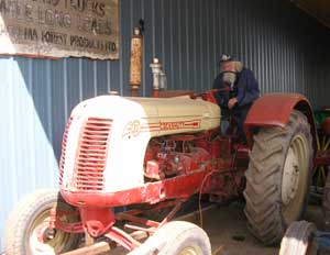 Marl takes care of everything in the museum and as he says, if it doesn't run, I don't want it. Here, he just started for us a 1949 Cockshutt tractor model "35". Model "35" is very rare as they were only built for 1 month. They combined model 30 front ends with model 40 rear ends as they moved to model "40s". Well this thing has it's battery charged for a day and when Marl turned the key, it fired on the first turn. |
Below are things we saw along the way.
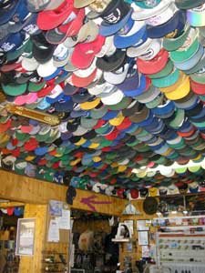 Rene, this place is famous for it's caps. Toad River Lodge AK Highway . Mile 422. Look on the wall where there is a pink arrow pointing to a cap. That is one of your caps. |
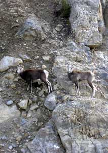 During a certain stretch there was all kinds of Big Horn Sheep. Boy, can they climb. This was after Muncho Lake. They are all over the place but will run away when you approach. |
 A new species called the ??????, any idea's for a name?
|
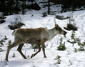 Reindeer's just ambling down the road. We saw these around Muncho Lake. They will walk right in front of your vehicle. You really have to watch these guys or else you could very easily hit one. It's almost as if they expect you to get out of their way. |
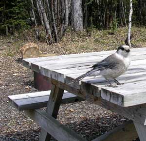 Our friendly Whisky Jack |
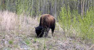 Wild Buffalo. After Liar Hot Springs there was a whole bunch of them but they stayed off the road. Thank the Lord. They are big. We ate Buffalo pepperoni and it was really good. We bought it at the friendly clean laundry mat in Fort Nelson.
|
|
Liard River Hot Springs Provincial Park - on the Alaskan Hwy |
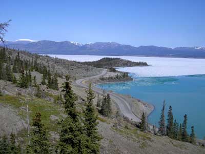
| Wednesday, May 17 2006 We boon docked near Summit Lake. The next day we went to Liard River Hot Springs Provincial Park. Along the way we saw so much wildlife that we had to be careful not to hit any. A lot of Caribou, mountain sheep and the occasional buffalo and moose. Pierre and Judy had been there before and what a treat it was. We enjoyed ourselves immensely. Pierre baked a chocolate cake for Denis's birthday. We had BBQ's with our new friends and exchanged many happy moments around the campfire. |
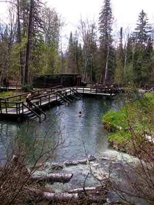 |
Alpha Pool Hot Spring (The main pool) The source waters of this Pool are 53 degrees Centigrade, and have the strong smell of sulphur and it bubbles out of the ground at the bottom of the picture to the left. Pool water mixed with the cooler spring waters produce pleasant temperatures ranging from 40 to 49 degrees C. It was only about 3-4 feet deep with 3 sections ranging from warm to medium to hot. You had to stir up the water as sometimes it got too hot. The bottom had small round stones, great for a foot message. This was also the site of a major construction camp for the AH. The natural hot springs were used by the troops daily, although once a week they cleared out, leaving the hot springs to the women of the camp. We enjoyed going in twice a day and then sat by the campfire. It's a hard life. Below is another Hot Spring which is very deep and has an even temperature. It was actually a much more comfortable temperature but the bottom was silt! |
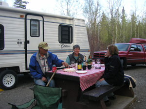 |
Pierre baked a chocolate cake for Denis' Birthday. He was a bit upset at the number but I told him he was just a day older. | 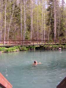 |
|
Watson Lake on the Alaskan Hwy |
| Saturday, May 20, 2006. We are at Watson Lake and have just left BC for the Yukon border. I purchased a fishing license, $25.00 per season and am hanging up my "Gone Fishing" sign. The fish in the lakes and streams consist of lake trout, Cisco, lake whitefish, Dolly Varden, salmon, burbot, northern pike. |
|
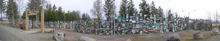
It was unbelievable to see. Watson Lake's famous collection of signs started in 1942 by Carl Lindley, a homesick highway construction worker. He erected a sign pointing to his home town of Danville, IL. The cluster of sign has been reorganized and new signs are added to the collection each year. What you see is only the front row... there are many more rows of posts behind these. The town of Watson Lake maintains the grounds.1991 had 12,000 signs, 2004 - 54,000 signs and today we added our sign to it. |
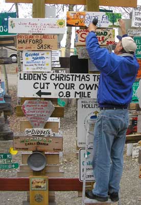 |
We have nailed our sign next to our travelling friends
from Quebec. Since we do not have a home right now, we decided to use
Iroquois Falls since we were both born there. To view the sign you would go
on the hill between the visitor's centre and the highway and look towards
the highway! We also saw two other signs there. One was from Curly & Dolly Faultbert in 1997 and there was one from Leanne & Blondie Lastchapelle beside it!.. small world as we had met a Quebec snowbird last Fall who Winters in Texas and is neighbour to Blondie. |
|
|
|
Side Trip - Carcross and Tagish |
| Monday, May 22, 2006. We went off the Alaskan Highway a bit to-day and went to Tagish and Carcross on Yukon Highway #2 It's a loop highway which takes you back to the AH and not very far to travel either. Carcross is a famous AH depot for supplies run up by Marine Highway. |
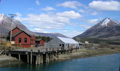 |
Carcross (Caribou Crossing) during World War
II, played an important roll in Alaska Highway construction as it connected
to the port of Skagway via the famous White
Pass Rail (gold rush of 88-89) and gave the U.S. Army access to the
Yukon's interior. By Spring 1942, the war moved
much closer to home when 1200 black troops of the 93rd Engineers stepped off
the train. Over 10,000 soldiers would pass through town and Carcross became
the distribution centre for road construction east to Teslin and northwest
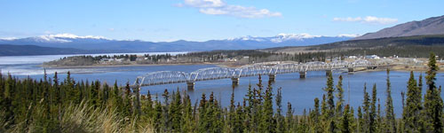
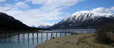
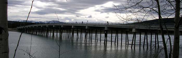
to Whitehorse. Here you see the old train station and docks on the river, which is also the headwaters of the Yukon river. Next is a picture of the White Pass Railway bridge |
 |
That fall, a contractor for the Canol pipeline (associated to the AH), Bechtel-Price-Callahan, set up a supply camp near the railway station. It was a busy time. Up to 25 trains a day rolled through town. Army trucks met the trains, then carried supplies to outlying road camps. Military planes flew in and out of the small airport. There was no lack of work for the local people. Johnnie Johns, a well known big game outfitter, leased and sold horses to advance parties for both Alaska Highway construction and the Canol Project. Johnnie and Peter Johns also guided army surveyors through the country they knew so well. Other aboriginal people worked at a variety of jobs, ranging from cutting logs for telephone poles to chauffeuring a general up and down the barely-completed highway. The town's services were modernized. Civilian contractors supplied many buildings with electricity and year-round piped water. Communications also improved when the gold rush era telegraph line along the railway was replaced by an eight-wire telephone/telegraph service. The "Friendly Invasion" also brought tragedy to Carcross. Many Tagish and Tlingit people were infected with diseases introduced by the soldiers. Despite the efforts of army doctors and devoted nursing by family members, many Indians died from measles, chicken pox, and dysentery. The soldiers and contractors departed as quickly as they had arrived. Their legacy was the network of roads that permanently altered the character of the community. |
|
|
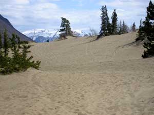 |
Carcross Desert is known as the smallest desert in the world. This area was originally covered by a large glacial lake. As the glaciers retreated, causing lower water levels, sandy lake bottom material was left behind. Strong prevailing winds from Lake Bennett have constantly worked this sand, making it difficult for vegetation to become established. Species of plants that have survived include Lodgepole Pine and Kinnikinnick. |
 |
 Three little birdies standing on the Tagish bridge, fishing. One named Judy another Pierre and then there is Denis. All trying their luck before we head into Whitehorse. Pierre says he caught all sorts of fish, last time he was here. |
|
Whitehorse on the Alaskan Hwy |
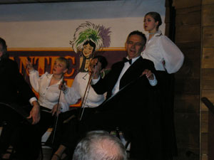
| Tuesday, May 23, 2006. We are in Whitehorse and camped out for the night at the Pioneer RV Park. The four of us went to Town to see "Devinchci Code". I considered it only as a movie and found it very entertaining. We also went and saw a cabaret show called the Frantic Follies. |
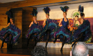 We went to see the "Frantic Follies", they were really funny and entertaining. Sorry pictures are not to good. I think they were moving to fast and the setting were not changed on the camera. |
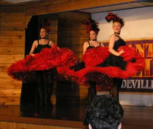 |
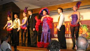 The evening was very enjoyable, they had us laughing nearly all evening.
|
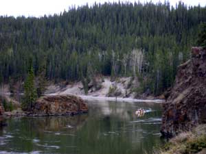 Canoeist at Mile Canyon, just outside of Whitehorse.
|
 An old Whitehorse tradition, playing the "Saws". |
We had stayed at the Pioneer RV Park just outside of Whitehorse and they were very good to us. They have nice wooded section above and another section of parking without trees in front of the highway, below. They had sent us to see the "Frantic Follies" for free. This was a complete performance rehearsal prior to the grand opening.
|
 Log cabin high-rise downtown Whitehorse. |
 |
It is so strange to see a show and go outside at midnight and it is still light out. It sort of gives you more energy. I cannot imagine what it is like with 20 hrs. of twilight. |
|
Side Trip off the A H - to Haines, AK |
| Wednesday, May 24, 2006. We continue on the Alaskan Highway tomorrow and at Haines Jct., we will part with our Quebec friends again, it has been so nice having their company. We will take a side trip south to Haines, AK going through the Kluane National Park on Yukon Highway #3. |
|
|
 This is
what we saw while at the summit of the Chilkat Pass for about a half hour!
See the view above!. This is
what we saw while at the summit of the Chilkat Pass for about a half hour!
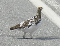
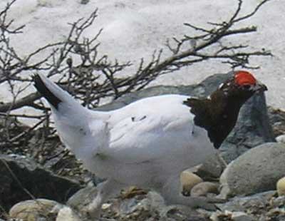
See the view above!.The male Ptarmigan
below running for his life from Denis. They kind of look like chickens but they live in the Artic so they are not so chicken. |
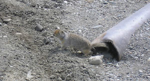
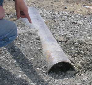 See the
little guy in the pipe on the left, well there is a better picture below.
This little guy is called an Alaskan squirrel or collared pita I am
not sure which. They are cute and curious little guys. They look for a way
to get into your trailer or coolers. They are all over the place. See the
little guy in the pipe on the left, well there is a better picture below.
This little guy is called an Alaskan squirrel or collared pita I am
not sure which. They are cute and curious little guys. They look for a way
to get into your trailer or coolers. They are all over the place. |
 |
 |
 |
Our first nights stay on the Haines Rd. was at Porcupine Crossing. This
was the view from our window. Not bad, eh! We met Gerry and Wendy Laurin camped here. They were nice enough to introduce themselves and asked us to join their campfire in which we exchanged stories. Jerry gave Denis a couple of his canned Salmon which we had for lunch and it was good. They live in Anchorage and Gerry has duel citizenship Canadian/USA. They will be at the Russian River CG for the opening day of the Red Salmon run (June 11, 2006). We may see them again. |
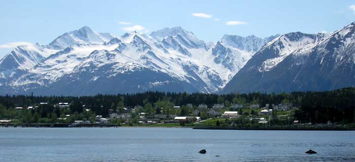
| Thursday, May 25, 2006. We have set up camp in Haines, AK today and tomorrow we will go to Skagway, AK by ferry, leaving our truck/trailer in Haines. |
|
The first settler were the Tlingit Indians. In 1741, the first known meeting between white men and Tlingit took place when a Russian ship anchored west of Haines. A brisk fur trade began thereafter with the Spanish, English, Russians and Americans. Later cashing in on the gold-seekers Jack Dalton established a tool road along one of the Tlingit routes into the interior. Parts of the Dalton Trail eventually became the Haines Highway into Canada. |
 Interesting things to see on the beach. An artist looking for a wife?
|
 A beached whaleboat.
|
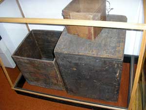 The Sheldon Museum and Culture Center has a very good display of the Tlingit Culture showing how artistic and resourceful they were. These boxes are of one sheet with folded edges. Their blankets and baskets were beautiful. |
|
|
|
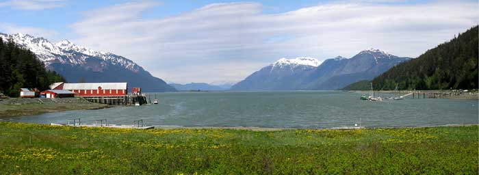
Side Trip off the A H - - Boat trip to Skagway from Haines, AK |
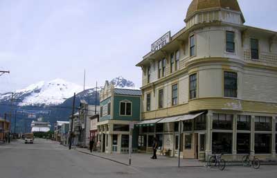 What was once the most notorious town of the Klondike, Skagway is now a nice little tourist trap. Of course I had fun shopping here. |
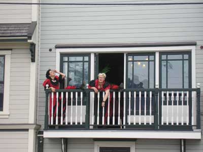 There was enactments of the Klondike Days at a local saloon. Denis will do the ongoing Klondike page as we visit the towns in which the Klondike Gold Rush was involved. |
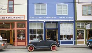 |
Stores line the streets and shiploads of treasure hunters visit. | 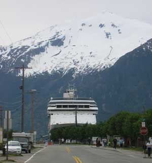 |
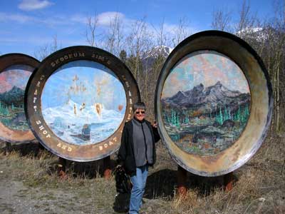
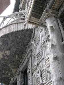
| This visitors centre was neat. It was covered with over 3,800 pieces of driftwood. | 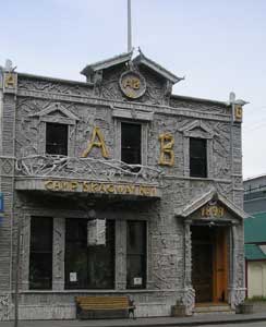 |
 |
|
Continuing on the Alaska Hwy through Tok and it ends at Delta Junction |
| Monday, May 29, 2006. We are back on the Alaskan
Highway and are at the "Solders
Summit", AK to-day. This is were they had the ribbon cutting for the
opening of the Alaskan Highway. The Alaska Highway from Dawson Creek, British Columbia to Big Delta, Alaska, was opened here at Soldier's Summit on 20 November 1942. Relying on local Native guides and generally following existing trails, the United States military and civilian personal finished the road in under 10 months. A lot of the original road is still part of the Alaska Highway. Its completion in 1943 opened the Northwest to southern exploitation of natural resources, altering Yukon settlement patterns and changing Native ways of life. |
 |
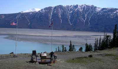 This is where the ceremony took place. See the ice! |
| This is a view on top of the hill where the ceremony took place. |
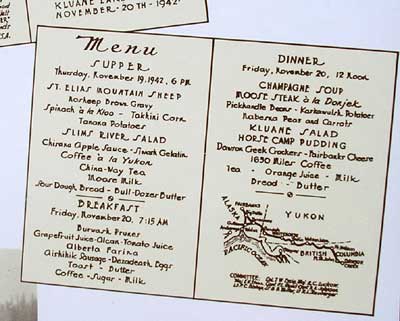 Menu for the people attending the ribbon cutting ceremony. |
| Wednesday, May 31, 2006. . There is about 30 kilometres between the
legal Yukon, Canadian border
and the legal Alaska, USA border crossing. You leave Beaver Creek, the
official Canadian border crossing, after getting your official Yukon
Sourdough Certificate at the visitors centre and then after 30 kilometres
you arrive at Delta Junction, the official USA border. There's nothing in
between and the road was like
cruising on a wavy ocean from frost heaving. The road was considerably better once we crossed
the USA border crossing. We are staying at the Sourdough Campground in Tok, AK |
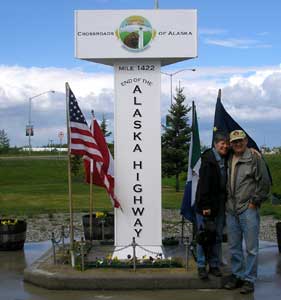
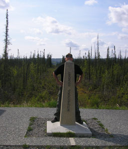 Denis is standing with left foot in Canada and his right foot in USA |
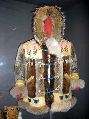 This is the latest fur jacket fashion. |
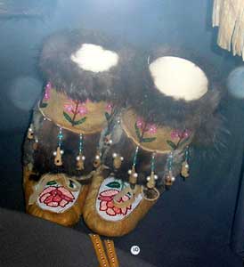 and mukluks to go with the jacket. Beautiful work. |
 |
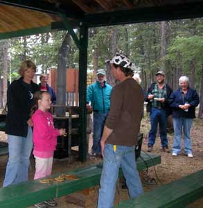 |
This is the Sourdough Campground just 1.25 miles west of Tok on Glenn Hwy. The owners are really friendly people who go out of their way to entertain and make it easy for you to meet other campers. Their food is very good and prices are very reasonable. We definitely would come back. |
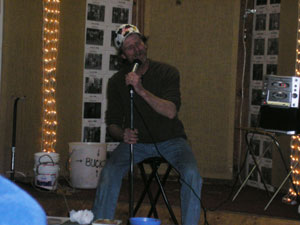
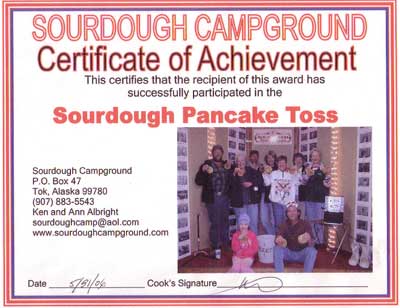 There I am in the middle of the picture for being a participant of the Sourdough Pancake Toss. I was Avana White. |
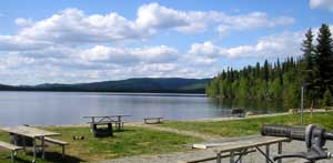
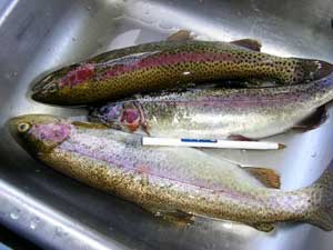
| Thursday, June 1,2006. From Tok, AK, we are heading north towards Fairbanks on our way to Denali National Park. We'll be back to Tok after we circle AK and head to the Tukon. On our way towards Fairbanks, we stayed overnight at Birch Lake and met some really nice people from Juneau. I only got the daughter's name, Della. Well they were catching Lake Trout one after another. We have decided not to get an Alaskan fishing licence. It is way to costly and so many rules. We will fish in the Yukon, since we have a licence for there and it's quite a bit cheaper. Anyways back to Della's family. They gave us tree of their Lake trout. Thank you, Della and her mom. I think her mom caught most of them. This is the second time an Alaskan has given us fish. We met Don and his wife just out side of Haines and Don gave us 2 cans of Salmon. They catch the Salmon and have a cannery can it for them. |
|
Our bounty from Della's family. I gave her our email and hope to hear from her. |
|
Home l The Beginning l Next