|
Salvation Mountain / Slab City, California |
| Sunday, February 26, 2006. We are on the road again. At first it felt strange but it soon became exciting and we are happy to be travelling again. Our first stop was at Salvation Mountain in Slab City, California. Was amazed at the mountain but did not like Slab City (an old closed up army base with just slabs of concrete remaining that the snowbirds and squatters have taken over). We've landed a beautiful place called Borrego Springs. What a lovely town and the Anza-Borrego Desert State Park is just off of it. |
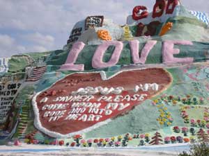 |
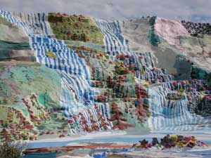
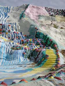
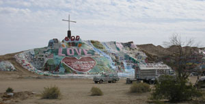 Salvation Mountainis a 20 year project for Leonard. Built originally of Adobe clay layered over the mountain then painted over, it now includes structures of tree branches, straw bales, all covered with an adobe layer and painted with donated paint. Leonard estimates he's used 100,000 gals of paint to date. The whole thing is a must see and Leonard is a very warm hearty man dedicated to giving the rest of his life to this project in honour of God. |
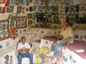 To the right is Leonard Knight who is 74 years of age and is from Burlington, Vermont. Salvation Mountain has brought Leonard many rewards and awards, some seen in this picture, others as plaques and books. He is known worldwide. |
 |
 |
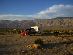 This is our latest campground. Clarks Dry Lake just outside of Borrego Springs in California. What a spot. We love it here and already wish we could stay longer and we haven't left yet. |
|
Anza-Borrego Desert State Park |
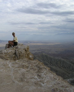
| Wednesday, February 28, 2006. Anza-Borrego Desert State Park is gigantic. The park covers more than 600,000 acres. It's pathways were shared by explorer Juan Bautista de Anza, the Southern Emigrant Trail, the Butterfield Stage and the Mormon Battalion. The Native Americans hunted and gathered here as long as 5,000 years ago. There were heard of mammoths and camels. I am sure if we come down with our trailer again, we will revisit. |
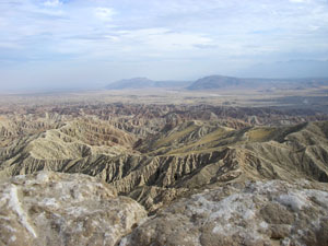 This is the badlands of Anza-Borrego Desert State Park. It is the erosion of sand stone into spires and peaks. |
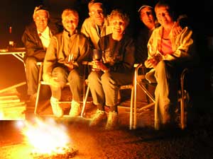
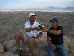 We were lucky enough to bump into Ken and Nadine again. We met them at the Natchez Trace in Mississippi. They were the ones who told us about this beautiful area. We are having a toast to the reunion. |
 This is his lovely wife Nadine. |
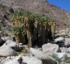 We are at Borrego Palm Canyon. |
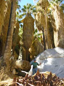 What a
view of the Giant Palms. What a
view of the Giant Palms. |
 We spent a really nice evening with the gang from Washago. We hope to get to know them a bit better when we get back home. Great People with a good sense of humour. |
|
|
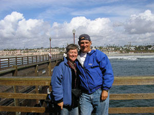 We drove, around a mountain, to Oceanside, on the Pacific Ocean shores for lunch and to say we were at the Pacific ocean. We had lunch at Ruby's located at the end of a pier right on the Ocean. This pier is the longest wooden pier on the Pacific Ocean. |
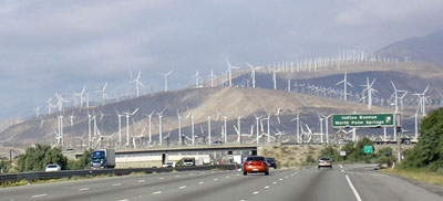
| Friday, March 2, 2006. We are on the move again, driving through Palm Springs north towards Joshua Tree NP. |
|
|
|
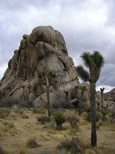
Joshua Tree National Park |
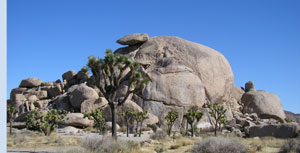
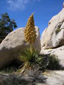
| Friday, March 3, 2006. We are now at Joshua Tree National Park. We have never seen this type of tree before. Seeing it along with the stone background makes us feel as though we are in Wonderland. |
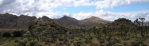 |
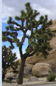 The Joshua tree, is a giant member of the lily family. Like the California fan palm, it is a flowering plant. We missed the flowering stage, in late February. I have seen pictures of the flower, it is beautiful. The trees were used by the American Indians for making baskets, sandals, and toasted/raw seeds made a healthy diet. In the mid 19th century, Mormons named the tree after the biblical figure, seeing the limbs of the tree outstretched in supplication, guiding the travelers westward. The tallest Joshua tree in the park looms a whopping forty feet high, a grand presence in the Queen Valley forest; it is estimated to be about 300 years old! These "trees" do not have growth rings like you would find in an oak or pine. This makes aging difficult, but you can divide the height of a Joshua tree by the average annual growth of one-half inch to get a rough estimate.
|
|
|
|
Mojave National Preserve |
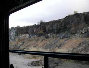
| Monday, March 6, 2006. We are travelling north, cutting through country roads heading towards Death Valley and right now we are going through the Mojave National Preserve and will boondock overnight around a Lava Bed. The last known volcanic eruption was 1,000 years ago. This 1.6 million acre park encompasses much of the Mojave Desert, as well as parts of the Great Basin and Sonoran deserts. About half of the park is designated wilderness, and is off limits to motor vehicles but open to hikers and horseback riders. After parking we explored a bit and found the area to be very restful and serene. We know there is much more to see here but maybe another time. We drove for 2 days through mostly the Mojave desert, and except for a few small deserted towns on old Route 66, we never saw another ranch or house along the way. Just desert!! |
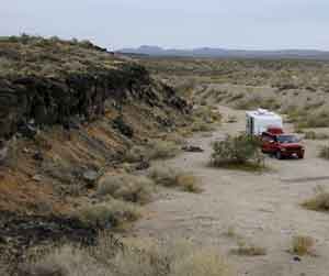 Here we
are parked next to the lava edge on our left. This is where the flow stopped
1,000 years ago. Here we
are parked next to the lava edge on our left. This is where the flow stopped
1,000 years ago. |
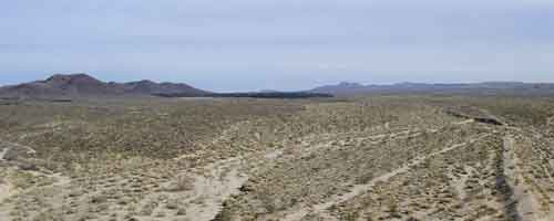 In the centre of the picture is the lava flow (dark part). If you look to the left you can see the mountains they flowed from. |
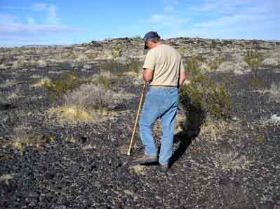 Denis is inspecting the lava floor. |
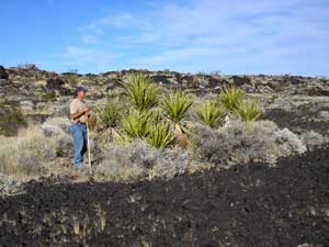 Even an oasis of plants can grow in this. |
 This is our morning view. Lava rocks. |
|
Death Valley National Park |
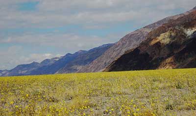
| Tuesday, March 7, 2006. We are at Death Valley, and staying at a campground in Furnace Creek. This is were we finally got a good downpour of rain, the first since October of last year. After the rainfall you get a strong scent of the creosote bush and bursage which dominates much of the park. I believe Death Valley is about 200 square miles. Everywhere you look there seems to be something to see and pictures do not do it justice. It's so beautiful. There are six different sections to the park. To cover it would take some time and a 4 wheel drive or good hiking legs is a must in some areas. In other cases it depends on the weather. They will close some areas down if they expect bad weather or there is construction, as it seems to be in a Northern section. |
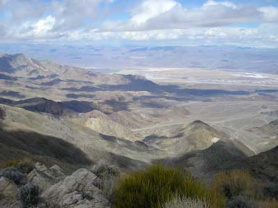
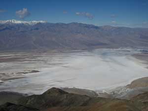 You are looking at Telescope Peak which is the highest point in western USA at 11,049 ft, and. Badwater salt flats, which is the lowest point in the USA at 282 ft. below sea level, all in the same picture, all at Death Valley!
|
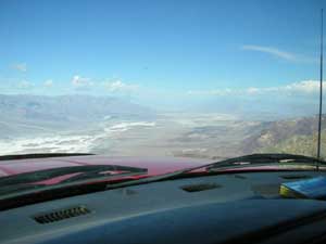 Here we are flying over Death Valley in a Dodge 2 seater Dieselprop!! The view is of the north 50 miles of Death Valley from Dante's View which is one mile high, and fuel tank is near empty! Stay tuned! (For more of Denis's B.S.)
|
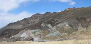 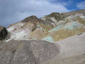 The two pictures here are from an area called the "Artist's Drive", It is a loop drive and especially photogenic because of the colors in the mountainside. The colors look as though someone poured a bucket of paint on top of the peak and the soil soaked it up while dripping down. |
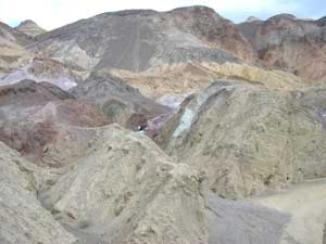 Various mineral pigments have painted these volcanic deposits. Iron salts produce the reds, pinks and yellows. Decomposing mica causes the green. Manganese supplies the purple. Colors on the "Palette" are reproduced in a larger scale on the mountains around death valley. |
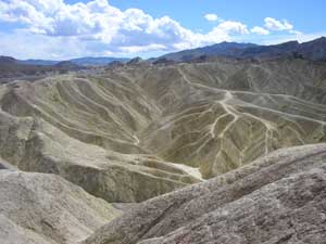 Zabrinskie Point is a Maze of eroded colored badlands. The name "badlands" is to be used lightly. There is nothing you could use this land for. You cannot drive on it and do not want to be caught here if it rains because it is all clay. |
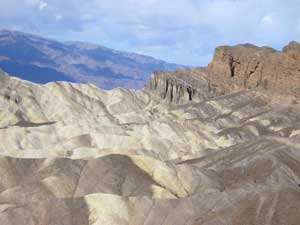 But is sure makes for a good view.
|
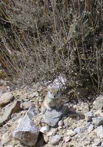
< Is this little guy cute? |
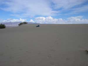
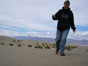 Denis says I never had a childhood so he has taken me to the sand dunes and we are playing here. It was fun. |
 See Denis rolling in the sand. I do not think Denis has ever grown out of his childhood. |
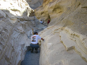 Denis is inspecting rock that has turned into smooth marble. Polished marble walls and odd mosaic patterns make up this canyon. Parts are so narrow that you have to walk single file. |
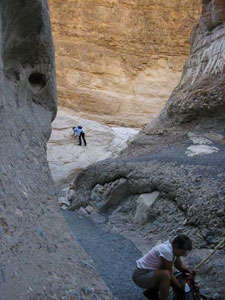 Look on the right of the picture. There are so many different layers of rocks. |
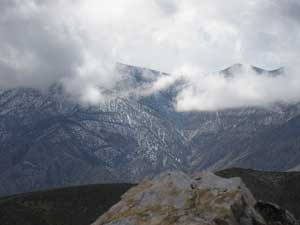 Here at Aguereberry Point we are up amongst the clouds. Yes, it is cold.
|
|
Death Valleyhas such extremes. You could be on the desert floor with flowers blooming one day and on top of a cold mountain in the next hour. |
 |
 |
| Monday, March 13, 2006. We're moving again and DV was a real treat. We're driving east through Pharump, NV. We will be at Lake Mead National Park, Nevada (to see this go to "Nevada" on "Trips" page). From there we will check out Las Vegas and area. Thank God we went to church yesterday. |
Home l The Beginning l Next