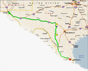
Well, we're on our way. It took us three days just to get to El Paso, and
we're
still in Texas!
Mind you we took our time and we are next to the New Mexico border.. so this map
is only
to El Paso.
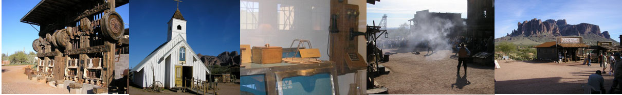
Our first stop was at a "western" town about an hour west of where we left.
It's called
Rio Grand City and it's an old town which has some of the neatest turn of the
century buildings still
left standing. It's unfortunate that it's not doing something about it. It might
be a bit too far for
tourists to go to, but I think, by the time that happens, these old building
might have to be torn down.
Here's a look at a few of them. Oh, and the cemetery is also very old and most
grave markers and
crypts are not even marked. AND, diesel is only $2.20 a gallon at Valeros.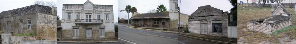
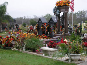
Now compare that cemetery to this modern one we saw a bit farther down along the highway. Spanish folks have a way of expressing themselves which is quite different from us when it comes to the burial of loved ones. One of these grave monuments even has a complete solar system in order to illuminate the burial site at night.
We continued on to downtown Laredo, looking for the old fort McIntosh on the Rio Grande and found out it was actually part of the University grounds. As such it did not appear to be a stand-alone tourist attraction as most of the fort buildings had various University department signs in front of them . Lucky for us it was New Years day, cause here I was towing the trailer right in the middle of a University campus. And, here I was, hoping to see where all the "banditos" crossed the river to hide out in Mexico! Laredo was always a major crossing into Mexico, even in the old cowboy days, and today it is the largest "inland" port in the southern US. It majors in the import / export of manufactured goods going mostly into the US.
Our final stop for the first day was in a great little town called Uvalde, TX. Everything about this town is western, even the cop car which is a pick-up truck, of course, and is done up in a "wrap" made to promote education on drug abuse. Neat cop-car eh?
Uvalde is a very clean town with a beautiful town square; has old turn of the century
buildings throughout. Even has a fully restored opera house which dates back to
the late 1800's. The best part of what to see, was the extraordinary collection
of western art and paintings, on display at the First State Bank - in a bank!
The collection includes paintings and bronze sculptures by Remington, Warren and
others. It even has a couple of sketches from Rembrandt! This collection is a
donation by former State Governor Dolph Briscoe, who is still alive today, and
he is by the way, the largest land owner in Texas. He owns more farmland than the
King family ranch! Do I hear Briscoe Ford pick-up in the makings? Here's a few of the
paintings we saw out of about fifty of them. They are hung throughout the bank
and even in the offices, and they just let you go about and enjoy them... so long
as you don't take pictures of the safe and things like that!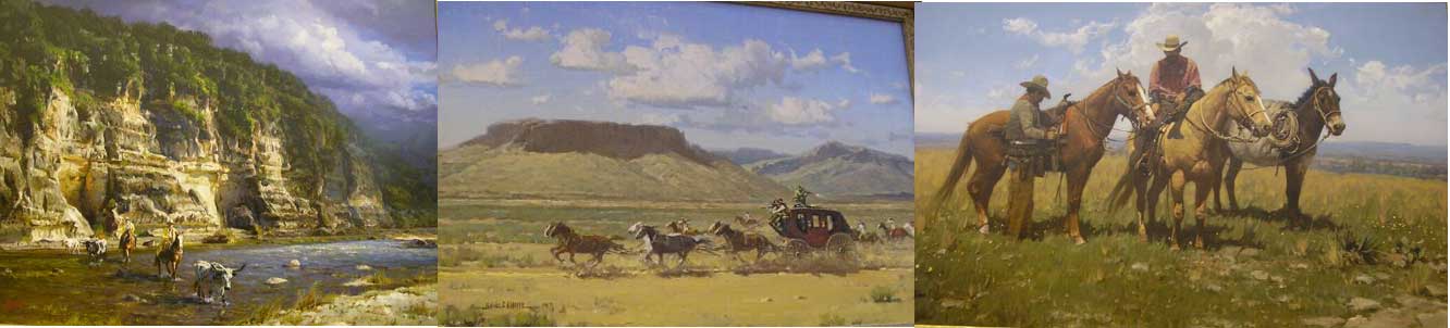
 I saved the best
for last. The price of fuel at the Super-Wally was... Diesel, only 2 cents
higher
I saved the best
for last. The price of fuel at the Super-Wally was... Diesel, only 2 cents
higher
than in El-Paso, which by the way, has the 2nd lowest price in the US,
and gas was 40 cents cheaper than at the same place in El-Paso, but only a bit
cheaper than in Donna.
Unbelievable! A little western town in the middle of no-where. I should mention,
this is the second town we have crossed paths in. Back in 2005 we went west
through Uvalde on our way to San Antonio, now we go north. The other place we
did this with was Goliad, a month and so ago.
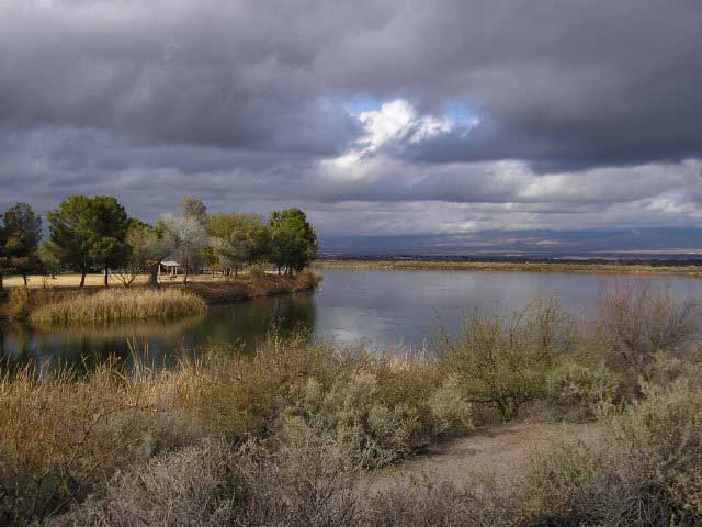
The next day we travelled up to Interstate 10 then went west. Since we left Uvalde late, we ended the second day at a road side boondocking spot just on the east side of the Pecos river. The Pecos, was a very wide river when we crossed it in 2005, about 60 miles south of here... but at this point, it's just a small creek! Very disappointing.
How about a bit of topography... The terrain we've seen in the last three
days speaks a lot as to how this part of this world was formed.
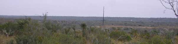
Starting in Donna, it goes from tropical farmlands
along the Rio Grande, to scrub grass lands which does not appear to be used for
anything, except for oil and gas. It's very flat, has shrubs and no trees. Elevations go from 40 to about 400'
once you get up near Uvalde.
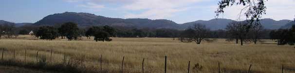
Once past Uvalde, going north you
start into the "hill country" of Texas, and here you get nice rolling
countryside with elevations in and up to about 2,000'. There are forests, lots
of rural properties, hobby farms and hunting is
a big deal here. As a matter of fact, deer season must be on as we passed a
pickup full of hunters in the box, guns in hand!
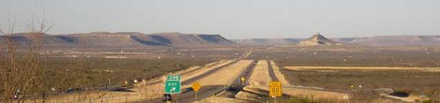
As you head west on Interstate 10, you start to get into some elevations
of up to 3,000' and you're mostly into flat valleys in between flat topped mesas
ranges on the horizons. It makes for beautiful
scenery. Here the scenery starts to look like what you'd expect Texas to
look like. Getting into Fort Stockton, you now climb onto a plateau, which is
basically a flat topped mesa you see here, except it keeps on going, it does not
come back down, and this is
what I call the "high plains deserts". Large wide open spaces and
ranches, a few dotted ranch homes, desert scrub land.
Here the land is mostly flat and at elevations
of about 4,500'. You also start to see Creosote shrubs and gravel in the
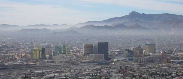
deserts, and there are mountain ranges of about 5-7,000' high. That's where you
find El Paso, TX. This picture shows the downtown of the City, the Rio Grande
river is in behind the buildings and that's a Mexican mountain range as a
backdrop. Elevation of the Rio Grande here is 3,500' compared to 40' in Donna;
and the smoke is Mexican!
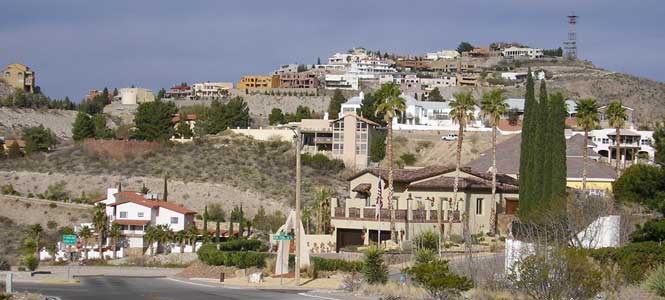 Our
night in El Paso is at Franklin Mountain State park and you guessed it, it's in
a mountain and our campsite is at 4,998' elevation. Well, did I forget to
mention Velma hates the cold, and the next morning it was 37F. So we went for a
ride to see the downtown, did a scenic mountain road overlooking the City and we
visited an old cemetery. Some sections of the City are very beautiful and as you
can see here, it even looks a bit like Hollywood! Everything else was
closed at it was Sunday... even the Tourism office downtown.
Our
night in El Paso is at Franklin Mountain State park and you guessed it, it's in
a mountain and our campsite is at 4,998' elevation. Well, did I forget to
mention Velma hates the cold, and the next morning it was 37F. So we went for a
ride to see the downtown, did a scenic mountain road overlooking the City and we
visited an old cemetery. Some sections of the City are very beautiful and as you
can see here, it even looks a bit like Hollywood! Everything else was
closed at it was Sunday... even the Tourism office downtown.
This cemetery, by the way was once called "Boot Hill" and yes, this is where the
name originates from. It's got real dead gunslingers and one especially bad
hombre by the name of John Wesley Hardin. He's reported to have killed over 30
men and in May 1895, was shot dead in El Paso.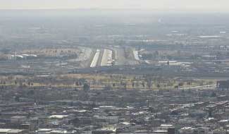
By the way, you're probably looking at the downtown picture saying, "where is
the Rio Grande river anyway"? Good question. Take a close look at this blow-up
picture and you'll see the river has been reduced to a canal.
See what looks like an airport landing strip? Well the dark line in between the
white parts is a concrete canal, and that's the Rio. The Border Patrol guys are
also building a continuous concrete wall along the Rio, so as to help prevent
illegal immigrants and the smuggling.
Seeing as it's too cold to stay here, we're moving on to New Mexico...
Jan 7, 2009, Safford, AZ. - 3,500' - Arrived at 12:30PM - 55F
Diesel fuel $2.38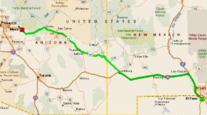
We left El Paso early and arrived at Lordsburg, New Mexico around 3:30 PM. We
boondocked at the visitors centre, and woke up the next morning to snow! Not
much, but enough to "git-us-going" again, as Velma has developed a real bad
allergy to that stuff. So, I hitched up the horses and off we headed to Safford,
Arizona.
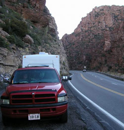
This leg of our trip takes us along Hwy 70, also known as the "Old West Highway"
and similar to "Route 66", it used to cross the US but at a lower "Cowboy West"
latitude. The section between Lordsburg and Apache Jct sets the scenes for
characters such as Billy the Kid, Johnny Ringo, Geronimo's birth place near
Clifton, numerous cavalry forts and posts, famous cattle ranches, mines and
breathtaking mountain views; especially the National Scenic Road, Hwy #191.
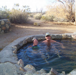
We found this really nice State Park, 5 miles before Safford, AZ. It's on a lake which was man made by some rich guy named Roper, hence "Roper State Park".
The park has a natural sulphur spring hot tub, as you can see, and while we
were in it, a roadrunner came by to visit us. The park was an ideal place to be
for Velma's "BIG" birthday on the 6th. Some beautiful roses, a gift, supper, and
hot baths in natural hot springs made her feel 20 years younger.... and a good
time for it too!
Of course the scenery helped also and this park has some very beautiful scenery.
The picture above is Roper Lake overlooking distant mountains with cloud cover.
The scene below was taken later on during the day near sunset, just as cloud
cover was lifting.
On Velma's birthday, day... the day of her birthday, Jan 6th... we vegged out and went to sulphur spring hot tubs in the middle of the desert on BLM lands (same as Crown Land) at a place called Hot Well Dunes... a recreational area in the middle of nowhere, and we spent more time in hot tubs! I played "slave" all day and Velma got everything she wanted!.
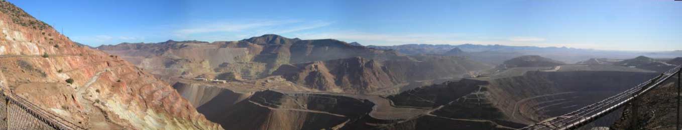
Today was a touring day to the scenic Hwy #191 which starts in a small town
called Clifton. In Clifton, we passed by the Copper mining giant Freeport-McMoran
(just bought from Phelps-Dodge). What a huge operation. It mines over a million
tons of rock per day. From one end of the mining operations, which started in
earnest in the Town of Clifton, in the early 1900's, to the present day mining
operations up the valley you see below, is a distance of over 4 miles! These
miners, in over 100 years or more have literally removed mountains. The
operations are so huge, it is mind boggling. This picture is of a small portion
of the current open pit operations. If you look closely over the top left side
of the circular pit below, at the right of the picture, you can almost see the
town of Clifton, down the valley. These guys have mined everything between here
and there, plus, this mining pit continues on way past the right side of this
picture.
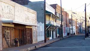
Clifton is an old mining town and reminds me of Schumacher in Timmins, and
some of the residential areas look very similar to those of old Copper Cliff in
Sudbury. The downtown area is in pretty bad shape, but they're working at
restoring the buildings as most are still standing and could be repaired. The
main street is very narrow because there is a creek named "Chase Creek" that
runs just in behind the buildings on the right side of the street. It has caused
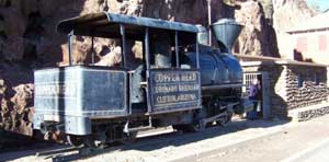
numerous floods and that's why the sidewalks are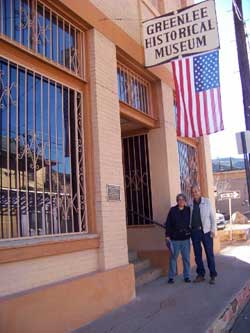 mostly 2-3' off street level. In the picture above, is the first locomotive to
ever be brought into, and used, in Arizona. It was for a mining operation. Next
to it is the old Town Jail and it's basically a stone building covering a small
mine drifted into the cliff behind it. Many folks still live in this town, but
the majority now live in Morenci, up the valley closer to the mine operations,
and that town is one of the last remaining company towns in the US. Every house
and commercial building is company owned and there's 3,500 workers at the mine.
mostly 2-3' off street level. In the picture above, is the first locomotive to
ever be brought into, and used, in Arizona. It was for a mining operation. Next
to it is the old Town Jail and it's basically a stone building covering a small
mine drifted into the cliff behind it. Many folks still live in this town, but
the majority now live in Morenci, up the valley closer to the mine operations,
and that town is one of the last remaining company towns in the US. Every house
and commercial building is company owned and there's 3,500 workers at the mine.
Clifton was found because of a cavalry chasing Apaches back in 1856. When the
cavalry went up this canyon, some soldier-prospectors noticed the copper on the
canyon walls. It's reported some of the ore around here was as rich as 20% pure
copper. We had sundaes in a restored restaurant with owner Rick Workman, who
introduced us to local history buff Joe Brinkley, a retired miner and operator
of the local museum. He was nice enough to open the museum for us and gave us a
great primer on the history of the town. Funny how stories of mining towns seem
to sound similar. Especially the one of a small adjoining town called Metcalf,
which was totally torn down so the mine could open pit the ground it stood on.
Happens all over.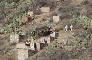
Now this picture is of a graveyard, set right on the sunny side of a mountain. Best view in town... if there was a town to look at! We don't know who it belongs to and forgot to ask, but, it probably used to belong to the town of Metcalf because this cemetery is right in the middle of Freeport's mining operations... it just sort of all of a sudden appeared right there on the side of this mountain. When you take highway #191 to the mountains, you have to drive through the Freeport mining operations to get there.. right by the pits, smelters, crushers, everything. Go figure how they buried these poor souls, some have concrete crypts. There are no roads, no walkways or trails to this cemetery, but there are some recent flowers.
The rest of the day was spent on one of the most beautiful paved road we've
ever taken, the scenic
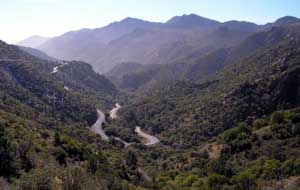 Hwy 191. This road
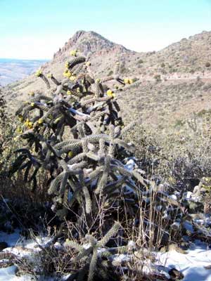 starts in Clifton, goes through the town of Morenci, then the Freeport mining
operations and then all the way over a chain of mountains, up to a town called
Alpine, about 100 miles away. We could only do about 25 miles at speeds of about
20-25 mph, which is as fast as you'd dare drive on this road. By 1:00pm we
realized it would take us till supper time to get to Alpine, then another 3-4
hours to drive back on a regular highway another 140 miles or so. So we turned
around and came back, but if anyone tries the whole trip, start real early and
try not to do the run with snow on the ground because you have to go really slow
down on the snow covered corners. And pulling is trailer is definitely not
recommended.
starts in Clifton, goes through the town of Morenci, then the Freeport mining
operations and then all the way over a chain of mountains, up to a town called
Alpine, about 100 miles away. We could only do about 25 miles at speeds of about
20-25 mph, which is as fast as you'd dare drive on this road. By 1:00pm we
realized it would take us till supper time to get to Alpine, then another 3-4
hours to drive back on a regular highway another 140 miles or so. So we turned
around and came back, but if anyone tries the whole trip, start real early and
try not to do the run with snow on the ground because you have to go really slow
down on the snow covered corners. And pulling is trailer is definitely not
recommended.
This scenic highway is non-stop, breathtaking mountainous scenery, with
wildlife, tons of switchback roads, camping and picnic areas, and as you can see
in this picture, lots of corners. This shot to the right is of a flowering
cactus in the snow and at the peak of a mountain pass at about 7,000' elevation.
You can just see the road behind it.
Well, tomorrow, we continue onto Old West Highway 70, into Apache Junction. It's about 2,000 kms from Donna, TX, and we've been at it for 7 days now, and should be there in another 2 days. It's cold in the mountains at this time of year. We're getting nights at or slightly below freezing and we're only at about 3,500' elevation. But the days are mostly sunny and warm. We haven't seen any 80 degrees yet like in Donna... Hi guys over there... we sure do miss the warmth and the pool! Wal-Mart is selling grapefruits here, btw, the same as what I got in Donna off the trees, and they want $1.14 each! Hello!!! I got 4 bags...like 25 per bag ready to juice.
Jan 8, 2009, Apache Junction, AZ. - 2,500' - Arrived at 10:30PM -
70F Diesel fuel $2.37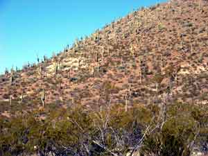
The trip to Apache Jct was very scenic as it took us through the Apache
reservation; a huge land mass of unspoiled desert scenery. Along the way we
stayed overnight at the Apache Gold Casino near the town of Globe. Here's a picture
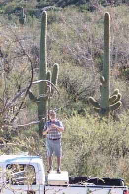
of the first giant saguaros (pronounced sawaros) we saw coming into
 Arizona, which by
the way, is the only state in the US with Saguaros. Globe and Miami are two
towns born out of the copper mining days of the late 1800's and both have very
scenic old downtowns which bring back nostalgic memories of the western days.
Globe also has an ancient Indian archaeological site called Besh-Ba-Gowah with a
few reproduced dwellings on the original excavated foundations. The site really
offers good depiction of how life was in the 1400 - 1700's.
Arizona, which by
the way, is the only state in the US with Saguaros. Globe and Miami are two
towns born out of the copper mining days of the late 1800's and both have very
scenic old downtowns which bring back nostalgic memories of the western days.
Globe also has an ancient Indian archaeological site called Besh-Ba-Gowah with a
few reproduced dwellings on the original excavated foundations. The site really
offers good depiction of how life was in the 1400 - 1700's.
The trip was easy going along the valley following the Gila (pronounced "hila") river, until we got past Globe. Then we headed straight into the mountains on a 2-lane highway with 6 to 8% grades. What a scenic highway it was as we traversed the Tonto National Forest, in through a small town called "Top of the World", then down a long picturesque narrow canyon, into the Phoenix valley. The ride was made even more exciting as they were fixing a few landslides along the way, and again, not driving in low gear, I saw my front brakes smoke-up! Here I am cooling them off, pretending to take pictures. Hmmmm.
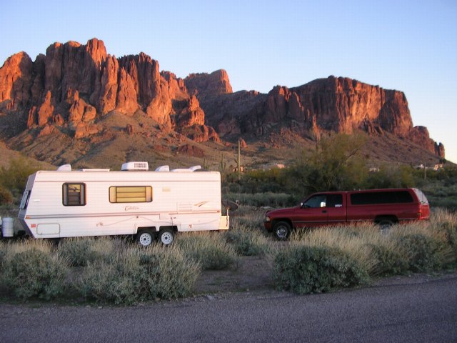
We finally arrived in Apache Junction after leaving Donna 9 days ago, and hitched up at the Lost Dutchman State Park.
If you start at the City of Phoenix, far west of us, you go through Scottsdale, then Mesa, then you get to Apache Jct. and from here to there,
it's almost 25 miles of solid CIVILIZATION!
But Apache Jct is really semi-rural, as the town itself is made of a few
residential subdivisions, quite a few trailer parks, and a lot of small properties and hobby farms. We're
located at the far east end of town on a road called Apache Trail which joins up
with the Old
West Highway right at a junction called Apache Jct, and at the edge of urbanization.
Our campsite is
 very picturesque with
the Superstitious Mountains in the background.
very picturesque with
the Superstitious Mountains in the background.
Now... rumour has it that a prospector died in the old days, with the location
of his gold mine buried with him. He also died with a hoard of gold in a box
under his bed, and analysis of his gold ore has determined that it does not
originate from any of the known ore bodies found in the area. Hence, word has it the mine is still
out there, and we're all looking for it!
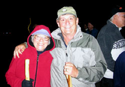
Now, mind you, there's not much you can see when looking for a gold at
night, BUT, here's Velma and me out on a 2-1/2 mile moonlight walk organized by
the Park. No flashlights allowed as it was a full moon, and we're not the only
crazy ones around here with gold fever, as about 125 people showed up! It was
fun, and the guides told tales of Superstitious Mountain, the Lost Dutchman Gold
mine and the goldfields mining area, all the while playing flute
music in the background while we were star gazing... hmmmm... hear that Andre!
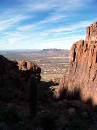
We went for two more mountain treks; one took us up the canyon you see
directly above and between the truck and trailer in the above picture. We went
about half way up, which is a 3.2 mile, 1,000' elevation climb. Some climbers went all the way up to
"Shiprock" which is the point with the sunlit face, in that canyon. That's
about a 2,500' rise in elevation and very difficult as there is no trail.
We even saw a cowboy from Colorado. He did the climb and he had on a
"six-shooter" in a western holster... cowboy hat, boots and all! You can do that
down here.
Here's a view of the valley from where we were and far in the horizon, is
Phoenix.
The area we are in is called the "Goldfields region" as it once had dozens of small gold mining operations. It still is being mined to this day, and there is a small two-man operation going strong across the road from us.
There's also a reproduction of an old ghost town across the road, and it's
really well done up as far as the buildings go. Right down to the old shoot-out
on Main St.
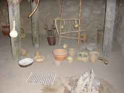
The first picture is of a 20 stamp mill "ore crusher". This is probably the only
one of it's kind left in existence, as I've never seen anything over a 5 stamper.
These things basically have 20 heavy steel rods which are lifted by cams, which
in turn are driven by steam engines turning belts onto the wooden wheels you see
there. These rods are dropped onto a trough full of gold bearing rocks. The
trough also has cyanide which reacts with the pulverized gold to form a paste.
As the heavy gold sticks to the cyanide and sinks to the bottom of the trough,
the lighter pulverized rock is washed away with water. At the end of the day,
the trough is cleaned of it's gold laden paste, and the cyanide is separated
from the gold by the use of a press. This 1870 mill was salvaged from a mine,
7,500' high in the mountains of New Mexico, and is 100% original. They are
working to hopefully have it back in operation some time in the near future, and
process some the gold ores from small local mining operations.
The next picture is of "the" church reportedly used in the movie, "Charro",
Elvis did! Quite a few westerns were filmed at this location. The third picture
really gets to me. On top of that old stove is an antique bread toaster. Dang, I
must be gettin' on because that's the same darn toaster I'm using in our
trailer. The next shot is your everyday, git-er-done, shoot-em-out, "Gunsmoke" show.
The last picture is a shot of the Goldfields downtown with Superstitious
mountains in the background. Our campsite is just below the mountain. Every time
I say that name I think of the old Goldfields hotel in South Porcupine!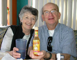
We had the opportunity to catch up with friends we had met on our travels the last time we came south. Lorraine and Jerry are from Orillia way, and have now bought a park model in a really nice resort in Apache Junction, and they gave us the two-bit tour. Boy, trailer parks have sure moved up a few notches. Now you have to call them resorts because they have so much to offer, and you never really need to leave them except for groceries. Here's they are at a local Mexican restaurant doing a commercial on Cholula hot spice!.... and here I thought Jerry couldn't take the hot stuff! Great folks to know and meet again...
Since we've been here now, the weather has been on the cool side evenings but
it's always sunny and warm during the day. Lately it's been only down to mid 50's
with days in the high 70's, and down right hot if you're out of the breeze. We sure
do miss those Texan winds... yuk-yuk-yuk.
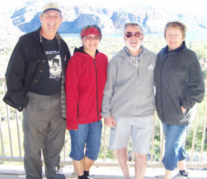
Well, it had to happen. We're here in Apache Jct and next door to us in the
town of Mesa we find our
old friends we were supposed to meet in Quartzite, Judy and Pierre from
Montreal. We met a dozen times or so, during our 2005-06 trip and we're at it
again. What luck. The four of us went for a ride up Apache Trail which is a two
lane road some paved, most gravel to the Roosevelt dam.
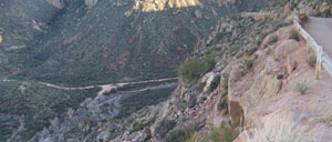
This road was once a
trail used by the Apache and is thought to have also been a foot trail of the Salado
Indians of 900AD and by the Anasazi Indians who built the cliff dwellings
thereafter. At the end of this scenic and super winding road are some of these
cliff dwellings and the dam. What a ride it was and the road at times was simply
gravel dug out of the mountain side with a sheer drop off of at least 1,000 feet. Built by 400 Apache natives in the 1900's, this road is
basically the same as it was then. At one spot, from down in the valley, we
could see a half dozen vehicles down one cliff-side, vehicles which did not make
it.
And for the fifty miles, you mostly see mountainsides full of giant saguaro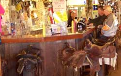 cacti.
Here's Pierre trying to take a picture of them... at eye level. Mixed in
are one of the three lakes
along the way which makes for a beautiful setting of sparkling blue waters
against the harsh brown desert.
cacti.
Here's Pierre trying to take a picture of them... at eye level. Mixed in
are one of the three lakes
along the way which makes for a beautiful setting of sparkling blue waters
against the harsh brown desert.
Along the way is the hamlet of Apache Pass. A small four building stop which has been there since serving as a way station for the building of the Roosevelt dam. It's got the greatest bar because of the seats... all saddles.
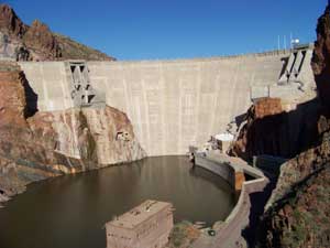
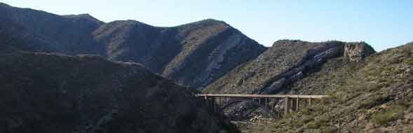
Once at Roosevelt dam, you are treated with the view of the dam, a beautiful
arched bridge and the historic cave dwellings of the Anasazi.
The dam, built in the 1903-07 period has since been added to by an additional
72' of elevation.
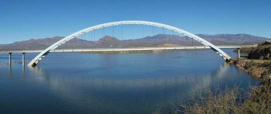
The bridge was built about the same time as the addition to the dam, since it's
new height flooded the old crossing. This bridge is considered to be one of the
ten most beautiful bridges in the US, and under the right circumstances, such as
we saw that day, I have to agree.
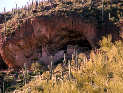
And finally, just around the corner on the right side of the bridge and down
the road about five miles is the Tonto National Monument cliff dwellings.
Vacated about 700 years ago, for unknown reasons, these dwellings are one of two
sites at this location, and were the only ones open to the public this day. The
others are quite a walk away and at a higher elevation. Considering these were a
trek of 350' in elevation, the others must be a real chore to get to.
Once you're there though, the view is great. But you really have to wonder, why
these people would live all the way up there. Just running for water is / was,
I'm sure, a half day trek to the river below, which is now a lake, but back then
would have been about two miles away.
Regardless, this Apache trail turned out to be a whole day trip. The gravel portion, though only about 45 miles, took at least 2 hours each way due to grades and the speed restrictions. The whole circle is called the Apache Circle Road, and it continues on from the cave dwellings, on a paved road, south, back to the town of Globe, which we described from Globe on into apache Jct. That trip would be too much for a day's run.
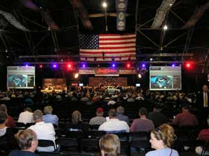
On our last day in Apache Jct, Pierre and I gave the women a break. We left
them alone! And we went to one of the largest, if not the largest, muscle car
auction in the US. It's called Barrett-Jackson's Westworld.
 I
have never seen such a collection of cars from the 60's and 70's in my life.
This week is a once a year event, and I mean it's BIG. We saw a limo from
Hollywood, so it tells you who some of the buyers are.
I
have never seen such a collection of cars from the 60's and 70's in my life.
This week is a once a year event, and I mean it's BIG. We saw a limo from
Hollywood, so it tells you who some of the buyers are.
These cars brought back memories. I saw two cars like the one Porter from
Iroquois Falls had in the 60's. A '67 Mustang Cobra 429 with the "shaker scoop"
hood and shark-finned rear window...only a dozen or so were sold in Ontario. I
saw Desrocher's Dodge Charger convertible 426 semi-hemi 6-pack of the same era.
And I only saw ONE '67 Pontiac Firebird like the one I had! These three cars by
themselves, still alive and original would probably fetch $2-300k and some
thought Porter's Mustang by itself would probably get that.
These cars were restored to mint condition! We must have seen over a thousand of
them and all were going up for unrestricted auction! There was the main
tent with both ends full of really really nice cars and the auctioneering being
held in the middle section of that huge tent (see side picture). Then there were
another five tents on the property with about 150 cars under each tent! I saw
cars I never knew existed. What a treat it was and I'm sure Glen of Schumacher
would have loved to have seen all the muscle Mustangs since he collects them.
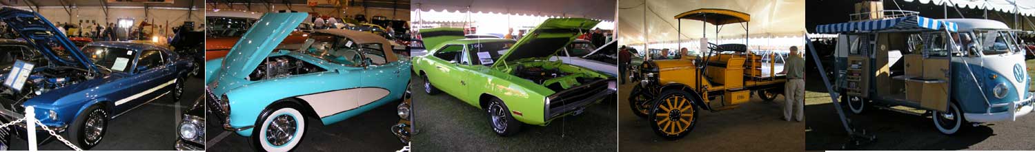
Feast your eyes on these babies (left to right)...a '67 Mustang Mack I, '57
Corvette Roadster, Charger R/T, a one of a kind 1916 GMC stake truck with
matching trailer (even GM could not find the paperwork on this one) and a fully
restored "love bug" camper edition. There must have been 30-40 60's Vettes, 100
Vettes all together and 100 or so vintage Mustangs! Mac, ya-should'a-been-here!
The Phoenix area has enough to do, to keep anyone busy for a few years. We never even went to see some of the famous museums, passed most attractions and events. There simply was not enough time scheduled for this place as we need to be in Quartzite for the "Sell-o-Rama" and Pow-Wow! It's easy to see why Mesa, Apache Jct, Scottsdale have so many trailer parks and resorts... there's a ton of things to do... if you can stand the smog... and it's unfortunate there is so much of it.
We must be getting on and tomorrow we ride into Quartzite for a week and some, then onto Yuma, AZ where we will investigate parking at another resort for February.