|
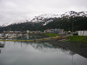
SEWARD
|
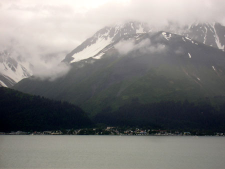
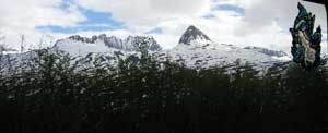
Seward across from Resurrection Bay |

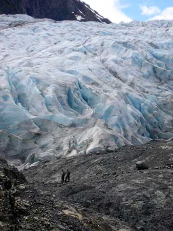
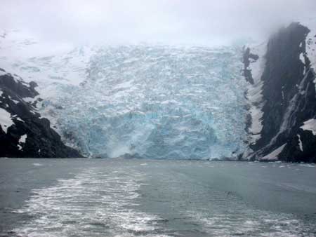
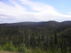
Exit Glacier from roadway into the Kenai Fjords National Park main
entrance. This is the only road that actually goes into the park. This
glacier is one of 32 glaciers produced by the
Harding ice field, which itself, covers most of the interior of the
Kenai peninsula with a few thousand feet thick of ice. There are more
Tidewater glaciers in this park (glaciers that still go right down to
the waters edge) than anywhere else in the world from one ice field...
even though they are all receding. The picture above shows the Exit
glacier at about 1.3 miles away. It was just below the picture in the
mid 1800's! The picture to the right is of two park rangers
surveying a new walking path as the one we are now using is too far
away... and it was built just 12 years ago!
|
 Exit
Glacier from hiking trail. Exit
Glacier from hiking trail.
|

Another view from SeaLife Center. Enjoyed petting all the live
stuff there. |
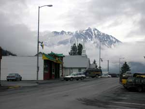
The down town has mountains around it. It's such a pretty view. |
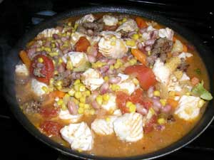
We met some really nice people from Switzerland and they went Halibut
fishing. They gave us some of their fish and I made a Halibut Stew.
It was really good. Thank you. |
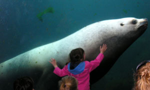
This was a very affectionate Sea Lion and a bit of a ham.
|
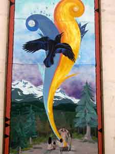 |
There
were painted murals on a lot of building downtown. |
Back 1 Home l Trips
l Map
WHITTIER
 Can
you believe we are still looking at Glaciers (a big piece of ICE). We went
for a cruise at Whittier. It rained the whole time but we made the best of
it. It helped that the cruise included a buffet of Salmon and Prime Rib.
What is a Glacier?
A glacier is a large body of ice that forms on land,
remains year-round, and is moving. Often referred to as "Rivers of Ice,"
glaciers exhibit many of the same characteristics of rivers. Like
rivers, glaciers begin at the top of the mountain and, taking the path
of least resistance, gradually make their way down the mountain under
the pull of gravity.
Although all glacial ice is moving down slope, not all
glaciers are advancing. Advancing glaciers and retreating glaciers
result from a net gain or a net loss. If more ice flows down slope than
is lost at the toe of the glacier by melting and calving (the process of
ice breaking from the face of a glacier), the glacier would be an
advancing glacier. The opposite conditions would signal a retreat. |
| During this trip I learned there are Ice Worms in the Glaciers. They
resemble a piece of dark thread and is 2.5 centimetre (one Inch) and .5
mills. in diameter. These ice worms eat red algae, which grows on glacial
snow packs and possibly pollen grains blown onto the glacier. Heat is the ice
worm's enemy. If the surrounding temperature increases much above 4 C (40
F), they become lethargic and begin to disintegrate. If a human finger
touches an ice worm it may instantly die from the heat.
|
To get to Whittier we went through a 2.5 mile toll tunnel through
Chugach Mountain, the longest tunnel in North America. This tunnel is
scheduled so that the trains go through and then vehicle traffic.
Whittier is suppose to have a mild maritime climate with a maximum of
84 degrees & a minimum of -29. Mean snowfalls is 260 inches annually
and winter winds can reach 60 miles per hour. It rained the whole time
we were there. |
Whittier is surrounded by the Chugach National Forest, the second
largest National Forest in the US, and three of North America's major
ice fields. The city itself is a historical landmark, established by
the U.S. Army during World War 11 as "the secret port". After the war,
the Army built two large buildings which are now landmarks. The
14-story Begich Towers is now a condominium that houses over half of
Whittier's population along with its post office, city hall and
medical clinic. There are quite a few restaurants here and just a couple of
gift shops.
|

ICEBERG!!! ICEBERG!!! Denis was so excited to see a floating iceberg
that he pulled over and took a picture just before entering a tunnel.
This iceberg is in Portage Lake and Portage Lake was made from Portage
Glacier. From our trailer park we can see Portage Glacier.
|
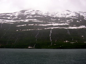
There are streams flowing down all the mountains from the melting
snow. |
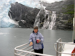
On my right a glacier, on my left waterfalls and in my hand a warm
Keni Kicker. |
Why is the Ice Blue?
Glacial ice is formed under pressure, creating ice
with few cracks or air bubbles, unlike the ice cubes in your
refrigerator. The visible light from the sun is made up of the
spectrum of colors that you see in a rainbow. When the sunlight strikes
glacial ice, most of the colors of the spectrum are absorbed - only
the blue wavelengths are reflected to your eye. On an overcast day,
clouds filter colors such as reds, oranges, and yellows, making
glacial ice appear a more intense blue. |
Back 1 Home l Trips
l Map
|
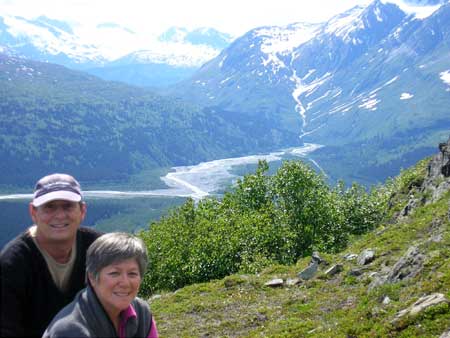
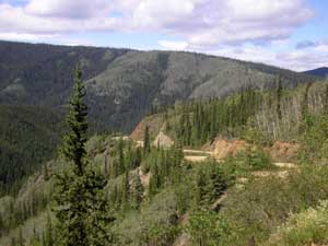
The picture to the left is at the top of Thompson Pass looking down
towards Keystone Canyon and is one of the most beautiful stretches of
highway in Alaskan. Mind you the hill behind us is no slouch either as
it descends 8% grade for about 5 miles. |
Major Historic Events: 1898 Gold Rush Stampede In 1964 the Alaskan
(9.2 measured) earthquake
totally destroyed the town of Valdez as it was built over a gravel
alluvial fan created by the Valdez Glaciers. The town was rebuilt 3
miles further upstream. The worst concentration of deaths from the
earthquake occurred here when the main dock which had 30 people standing
on it suddenly dropped 30 feet into the water. (on Good Friday)
In 1970's, the port of Valdez is the southern terminus of the Alyeska (Alaska) pipeline
and Marine Terminal.
In 1989, everyone remembers the Exxon Valdez and the
near total contamination of Prince William Sound which has to be one of
the most beautiful area's in the world. (also on Good Friday) |
| A little tidbit about Valdez, Alaska: Average annual
rainfall = 64.04 inches
Average snowfall = 325.6 inches
Record snowfall = 560.7 inches (1989/90)
Record sun = 33 days above 70 degrees (2004)
Summer Average= 53.5, High = 60.8, Low = 46.1
Winter Average = 22.5, High = 27.9, Low = 17.9
June = Average Tamp) = 55.5, Day Light = 19.5 hrs.
|
= I would have to say this applies to a lot of places in
southern Alaska. I could be wrong. Some
places less and some more. |
Back 1 Home l Trips
l Map
|
The Copper River |

This is the Copper River. Here you get the best Salmon in the world. You
have to be a native Alaskan resident of to fish for the red, silver, and
king salmon with dip nets and fish-wheels with limits of up to 500 salmon in
possession.
The mountains visible is volcanic Mount Drum (12,010), part of the
Wrangell Mountains. |

Anyone can dry-camp here and we choose to stay and watch the action and what an interesting
event it was. This was also our staging area for visiting Kennecott 60
miles away.
|
Here we have people fishing with dip-nets. Scraping bottom with them and
hoping to scoop up a bundle. |
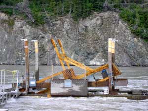
A fish-wheel. The wheel turns like a wind mill being pushed by
the current and hopefully scoops up the fish then dumps them into a the holding
cage. |
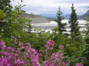
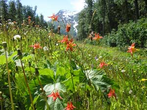
Spring has sprung and the wild flowers are in bloom. |
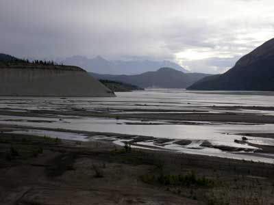
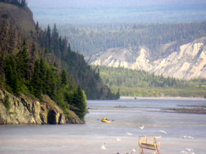
This are is a view of the confluence of the Copper and Chitina Rivers.
The Copper is the only waterway that cuts through the Chugach Mountains.
The Copper is about 1/2 mile wide, while the Chitina is over one mile.
The rivers look dirty...but they are not polluted. These waters begin as
flowing "rivers of ice." Millions of tons of rock dust are scoured off
of distant mountains by glaciers and carried downriver each year. The
silty waters hide salmon swimming up these rivers to spawn. Copper River
"Reds," (sockeye salmon) are world renowned.
|
 |
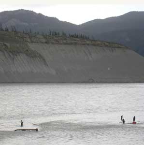
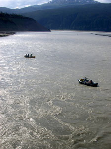
We met Brenda, Katherine and James at Copper River. They are from Homer. The river that you
see them rafting on in the pictures. There was an auction and Brenda had bid and won
this trip for her friend only to find out the friend did not want to do
this rafting trip on the copper river from Chitina to Cordova so now the
good sport that she is has taken her family on an adventure that they
will never forget. By the way Brenda is a Canadian and seems to be
living life to her fullest. Keep it up Brenda. Life is way too short. |
 |
Back 1 Home l Trips
l Map
| This part of Alaska is special. Here you first reach
the historic town of Chitina (pronounced Chit-na) where two civilizations live.
First the original native settlements found to the south of town which
date back to pre-explorer times are still occupied, and the town itself, which is currently
mostly inhabited by "Outsiders" who moved to Alaska in the late 60's
early 70's, many from the Vietnam war era. But this town really came to being
in the early 1900's when it was a major supply centre for the Kennecott
mine. Just a mile past town is the copper river where we are camped out.
The Kennecott mine built a railway line from the mine site all the
way down to Cordova on Prince William sound (Pacific ocean), a distance
of 196 miles, to ship its ore to Washington state for
smelting and refining. Chitina is at a midpoint, about 60 miles from the
mine site. The Copper river crossing, where we are, had a wooden trestle which was
wiped out every Spring by the river ice break-up. This trestle was about 1/4
mile long and had to be rebuilt every Spring! You can see a picture of
the river up above as we took from the concrete bridge. The road into
Kennicott is over the old railway line and sometimes, you still see the
railway ties or the odd spike coming out of the roadbed!
At Kennicott, the mine mill is the attraction and is now part of the
Elias National Park. The town itself was small with all workers except
management, living in bunk houses. The next town 5 miles over, McCarthy
existed mostly because it provided services Kennecott mines would not
allow in Kennicott, such as competing general stores, saloons and
establishments with "loose
ladies"! Ah, the good old days. |

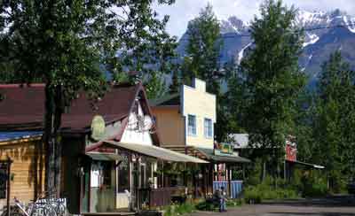
View of the Chitina downtown. Hotel has recently been renovated, next
one is partly done and the far one is an original 2 storey log
structure. This is a really nice small town with very friendly folks,
many of whom have been here for 35 odd years. |
This is downtown McCarthy which is celebrating its 100th! . Pop about 50 in the summertime, a few less in
Winter. Again, great folks, and as always, renovating buildings, which
is a major feat since they are 60 miles down a narrow gravel road which
used to be a railway bed and another 100 miles to the nearest building
centre! |
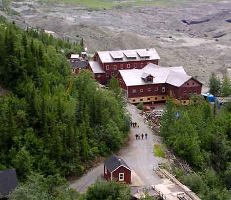
View of downtown Kennicott from atop the mill. You see the watchman's
shack below, the general store being refitted with a new foundation and
one of the many bunkhouses for the workers next to it plus a partial
view of the school house beyond. The bunkhouses, by the way, were
occupied by 2 shifts of men who had to give way to the next shift when
they went to work! The gravel piles past these structures are not
tailings. They are the remains of the Kennicott glacier. Under the
rubble is solid ice which is still melting away and which 100 yrs ago
was at least 200 feet higher. |

This is the famous Kennecott mill... the mine itself is about 2,000 feet
higher up in the mountain behind it. This mine made the owners...JP
Morgan and Guggenheim brothers, richer still as it was the richest
copper find ever. Reported overall grade of the copper ore milled was
17%, some of which was 70% straight from the mine. Visiting this place
is going back in time like nowhere else because when they shut this mine
down, they basically took everyone out of town and said, this is the
last train... get on or walk out! Supposedly, some homes still hade
meals left on the tables, years later! |
Back 1 Home l Trips
l Map
Back 1 Home l Trips
l Map
|


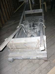
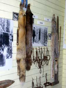 Furs
trapped for clothing for the 70 below weather.
Furs
trapped for clothing for the 70 below weather.